HOOKER HISTORY - PROSTITUTING OUR NEW ZEALAND HERITAGE
Once
upon a time there was a placid and progressive little country at the bottom end
of the South Pacific, where most everybody was getting on fairly well... then
came the whores...
The
Nathan led cabal, which mounted the false land claim against Allan and Susan Titford
in order to steal their clear freehold title over lands sold to the Crown by Chief
Parore Te Awha, in 1876.
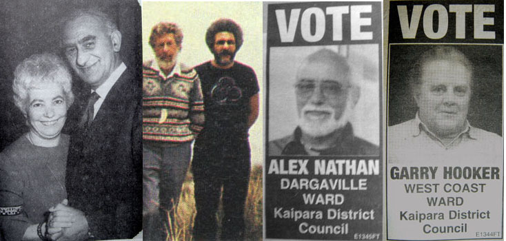
To the far left is seen Katina
& Ned Nathan. Katina was from Crete and was of full Greek lineage. Ned is
estimated to have been 5/8ths Maori, 1/4 European & 1/8th Portuguese. The
coloured picture shows Ned's son, the half Greek Manos Nathan in a black "T"
shirt, standing beside Dr. Neville Hogg*. The picture was taken at the time Manos's
Pouwhenua pole was raised before T.V cameras on Titford's private farm property.
The great kaumatua of Te Roroa, Alex Nathan is seen next, trying to get himself
onto the council. Australian born (?) Te Roroa claimant, Gary Hooker is seen also
trying to get a foot in the door within the council. He is only 1/8th Maori, but
acts in the role of propaganda minister for the cabal. The true facts of Te Roroa
history, as contained within this article, are very conspicuous by their absence
in Gary Hooker's very selective, self-serving approach to interpreting "history".
*Note:
A prominent farmer around the Maunganui Bluff district, Mr. Downey, while
deep in the bush at the Bluff many years ago, heard a strange and loud incantation
nearby, so sneaked over to the source of the tumult. He found Dr. Neville Hogg
in ritual ceremony, arms raised in devout supplication and earnestly invoking
Maori gods. Dr. Hogg used to spend a great deal of time wandering through the
forested hills in the area, exploring. The Nathan cabal were quick to use him
as a European figurehead in support of their very dubious cause, presumably to
win-over some European sympathy or to promote the illusion that there might be
some substance or legitimacy to what they were claiming. They, thus paraded Neville
Hogg gratefully before the cameras at the raising of Manos Nathan's Pouwhenua.
Noel
Hilliam, former Curator of the Dargaville Maritime Museum, well remembers Ned
Nathan coming to the Museum in 1980 and asking for source information on local
whakapapas (genealogical links). Mr. Hilliam supplied Ned Nathan with a copy of
the rare book, The Peopling of the North, by F. Percy Smith,
for in-house reading on museum premises. After some considerable time spent perusing
the book, Ned exclaimed, 'Oh, that will do'. He wrote out a family tree,
then, according to Noel Hilliam, crossed out a name and inserted another in its
place. Noel considered the act to be quite strange, until a few years later, when
Ned Nathan became heavily involved in the Waitangi Tribunal and land claims, with
himself and his immediate family as the primary beneficiaries. Noel, thereafter,
strongly suspected that Ned Nathan had manufactured some aspect of his whakapapa
for the land claims process. Other Maori in the know have commented that the Nathan
whakapapa has areas "that are in spirit only".
The Nathan
family name is, in fact, a bit confusing due to a lot of swapping around of the
name of a shipwrecked ancestor, Nathan Porto-ava who was on the French
ship L' Alcemene, which was wrecked on the Northwest coast in 1851. Nathan or
Natana Porto-ava or Patuawa was, as best we can determine, from
Fortune Island, Batangos, Philippines. On the centenary of Nathan Porto-ava's
death a memorial tribute was held at Taita Marae, and written up in the Dargaville
& District News, October 7th 1998. The paper stated that Natana
Patuawa 'was the son of a great chieftainess and belonged to the Ngapuhi tribe.'
The paper tribute goes on to state: 'During his life Natana collected money
for Hone Heke [a grand nephew] and was a known travelling companion of Bishop
Selwyn and Henry Williams'.
Hone Pokai Heke died in 1850, a year before
Nathan Porto-ava arrived in New Zealand at the youthful age of 18-years, so the
statement can't be in reference to him, although he's the only "Hone Heke"
that the public, at large, would think of. It's quite probable that this statement
to reporters was merely a "sleight-of-hand" trick to make everyone
think of Hone Pokai Heke, when in fact the spokesperson was referring to, virtually
unknown, Member for Northern Maori, around the turn of the century, Hone Heke
(circa 1900). Irihapeti Patuawa, daughter of Nathan Porto-ava and his wife Tarati,
was born at Paihia, so it's very likely that the family had encounters with both
Bishop Selwyn and Reverend Henry Williams. Tarati was, possibly, Ngapuhi, so perhaps
Nathan Porto-ava was considered Ngapuhi by adoption or marriage. Some Te Roroa
commentators state that Tarati was Ngati-Whatua.
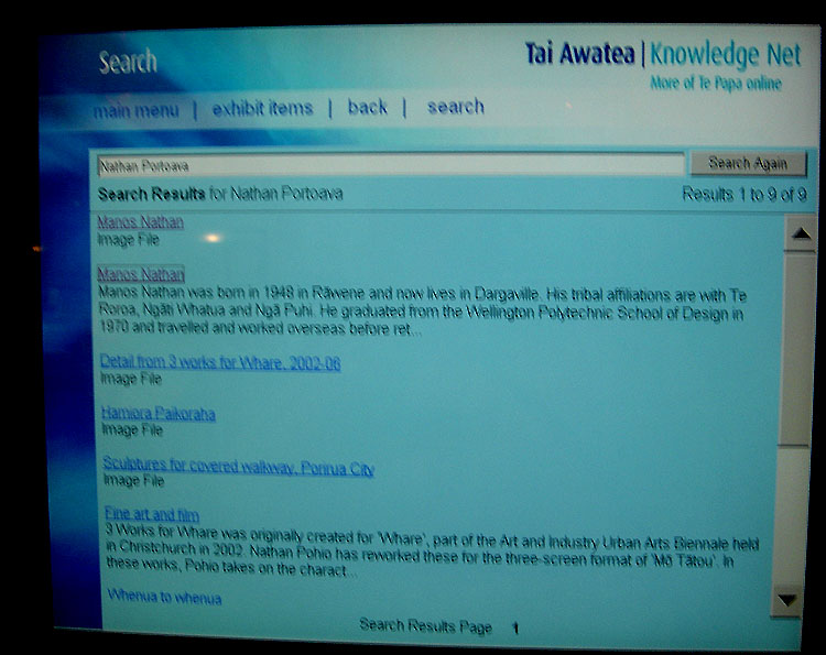
At
Te Papa Museum in Wellington, N.Z., contributors to the collection get honourable
mention and feature on the in-house computer. When one puts the name Nathan
Portoava into the computer, the name of Manos Nathan,
along with a photo of him, appears on screen. Inasmuch as Manos Nathan fabricated
some ceramic pots for the Maori section (Maori never fired pots or had any knowledge
of ceramics), an article is included about him. His name is listed variously as
Manos Nathan or Manos Nathan
Portoava.
Ned told historian Joan Leaf that his brother was the
Anglican minister of Rawene, who bore the surname of Patuawa, whereas Ned's
surname was Nathan. Joan found this to be quite strange. Even the
family genealogy is confusing, as Ned claims that his parents were Aperahama (Aberaham)
Natana and Sophia Urikore Cummins. Although Alex Nathan says the couple had 8-children
of which Ned was the 5th, Internet genealogical references, submitted by close
family members, state that Aperahama's & Sophia's union produced no children.
Were Ned and his Anglican minister brother adopted? Do the present-day cabal leaders
of Te Roroa, Alex and Manos Nathan, have any Te Roroa blood links at all? As stated,
one Te Roroa commentator said, 'you must realise, of course, that parts of
the claimed Nathan whakapapa are "in spirit only"*.
*Footnote:
In the late 90's there was an incident at a Marae (Taita?), where the claimed
Nathan whakapapa was called into serious question. Alex Nathan was giving an oral
delivery of his whakapapa, when he was interrupted by a leading Northland kaumatua
who stated, 'you cannot claim that ancestor, as she was
barren and had no children'. Alex Nathan is reported to have stopped his
delivery forthwith and taken his seat, looking very embarrassed.
Prior
to the eighties, the Nathans had lived for about twenty-five years in the Porirua-Wellington
district, around Titahi Bay, where they ran some sort of Greek restaurant. They
were known locally as "The Greeks" and tended to promote their
Greek links and culture.
A "gushy" propaganda article about the
Maori-Greek Nathans was written by "twisted Greek racist and hater
of all things British", Athena Lambrinidou and appeared in Odyssey
Magazine. For this truly nauseating, brown-nosing account, very insulting
of the sacrifice of European soldiers who gave their lives in Crete during W.W.II,
or showing Lambrinidou's utter ignorance of true (non-propagandised) New
Zealand history, see: http://www.odyssey.gr/article.asp?pagecode=02&entryid=1326
It
would appear strongly that, with new legislation brought in to empower the Waitangi
Tribunal, Ned and his offspring saw a unique opportunity to make major financial
gains as "born again Maoris", so moved from Wellington district
to get a claim underway for themselves in the north. Thereafter, Ned got very
active, in collusion with close mates like Graham Latimer, to get his finger in
the rich grievance-industry pie and set himself up as the great new kaumatua of
Te Roroa, supplanting the authority of the more placid or traditional royal families
of the district in the take-over process. He also managed to get plenty of co-operation
and help from family members who had taken over government departments, like Sam
Brown (Head of Lands & Survey) or Tom Parore (Head of the Land Court). The
Nathan network developed very far reaching tentacles of influence that extended
into the highest levels of government or law.
In the best traditions of
"the squeaky wheel gets the oil", a vocal and militant cabal
of usurpers was formed, the mantel of which has now passed to control-freak Greek
and "born-again Maori", Alex Nathan. The new great Maori leader of Te
Roroa, Alex, now has to be consulted on everything to do with the Dargaville-Waipoua
Forest district, even, apparently, down to recent desires for David Bellamy to
film and comment about the grand Kauri tree, Tane Mahuta, which Alex refused
permission to allow...a pretty amazing con-job for someone who is only about 1/4th
Maori and, of that, only 1/8th Te Roroa hapu, depending on whether or not Sophia
(Sophie) Urikore Cummins-Natana truly was his grandmother.
Dignified Te
Roroa kaumatua and respected elder, Jock Leaf, once owned substantial tracts
of land in and around the Waipoua Forest, which he had legitimately purchased
off other Te Roroa owners during his long lifetime in the north and for which
the family retain documentation. Since Jock's passing on December 24th, 2005 the
family have come up against a brick wall in getting any acknowledgement of their
holdings and are very concerned that Alex and the cabal are attempting to "absorb"
the land owned by Jock's heirs. Based upon the cabal's latest land-grab "Information
Pack", issued to their inner-sanctum of conniving members, this
could well be the case. A locked gate has, for over a decade now, blocked a pubic
road bridge across the Waipoua River that leads to a very large tract of prime
public land stretching up the coastline. The Nathan cabal, in collusion with forestry
and DOC control-freaks, determine who can enter and who can't. The much aggrieved,
righteously-indignant cabal, forever shedding crocodile tears and bemoaning their
"dispossesed" state or the historical injustices committed against them,
wants all of this "compensatory: territory". In fact, the eternally
lamenting Nathan cabal wants much, much more, ranging from Dargaville, where they've
seen a vacant lot that tickles their fancy, all the way up the west coast to the
Hokianga Harbour, throughout which stretch it is their heart's desire to "absorb"
many large parcels of real estate and lucrative commercial resources.
"Ab-Zorba
the Greek", Alex Nathan and his parasitic leech cohorts, are despised
by the more normal and less militant members of Te Roroa, who resent the terrible
disruption and ongoing conflict this "born-again-Maori" family
imported into the north during the 1980's and thereafter. The Nathan-backed gang
of thugs harassed many peaceful farming families and started fights, deliberately,
in an effort to claim & "absorb" many coastal farms, by forcing
government intervention to diffuse the situation.
Hardworking farmwife Elizabeth
Bibby was labelled a "Nazi Bitch" then both she and her husband
John were constantly harassed and intimidated for about twelve years by the thugs,
until forced to lose the farm by a false land claim mounted by the Nathan-led
cabal. The same thing has happened to a drove of other titled land owners in that
troubled northwestern coastal district, a fact that goes unreported and remains
unbeknown to most New Zealanders. There is growing list of people in the north
who have fallen victim to the Nathan brand of government-backed psychological
warfare and had their lives and livelihoods ruined in the process.
In the
very near future, the Nathan-led cabal has ambitions to defraud the New Zealand
public and private landowners out of the following substantial parcels of land
and commercial resources.
Have
a look to see if the Nathan cabal are planning to grab your property as well...
Maybe you're the owner of that "vacant section" in Dargaville that they're
eyeing up for acquisition in the very near future. These documents were acquired
from a disenchanted member of Te Roroa, who is sick of the deceit and fraud being
perpetrated by the Nathan cabal.
THE
TITFORD'S... THE FIRST TO FALL FOUL OF THE GREEK MAFIA
Michael
Corleone: My father made him an offer he couldn't refuse.
Kay Adams: What was it?
Michael Corleone: Luca Brasi held a gun to his head,
and my father assured the bandleader, that either his signature or his brains
would be on the contract. (See The Godfather,
by Mario Puzzo).
After years of government tolerated harassment by squatters,
constant Nathan led intimidation or violence, assaults and punch-ups by Maori
claimant thugs and police, death threats and near misses from bullets or "bump-you-off-the-road"
cars, ongoing sabotage of farm equipment, cutting and removal of fences, arson
of their two farm houses resulting in total destruction of all their personal
belongings, ongoing rustling or murder of stock, confiscation of firearms
by the police to leave the isolated farming couple unprotected in the middle
of Apache country, deliberate government interference to make it impossible
to run the daily affairs of a viable farm business, freezing of assets by
the government owned Rural Bank using "starve-you-out" stalling
tactics of withholding funds or outright confiscation of farm transactional
money, devaluing of assets by getting DOC archaeologists to declare fake wahi-tapu's
indiscriminately around the property in order to strip away land value and
force bankruptcy, constant court appearances on concocted or trumped-up charges,
regular character assassination by a biased and government controlled bunch
of media whores, attempts to have Allan Titford declared insane by offering
tempting financial enticements to members of Allan's own family including
his brother Brian and father, denial of basic human rights under the Land
Transfer Act 1952 and a host of other Acts, allowing no funding for self-defence
in court when the opposition were given several hundred thousand dollars in
legal aid to prepare and mount a case before the Waitangi Tribunal, no right
to defend their freehold farm title in a court of law, threats to valuers
who made fair appraisals of the Titford farm and assets, threats to law firms
engaged by the Titford's that they'd get no future government work or funding
unless they dumped the case, etc., etc., the Titford's were forced, under
extreme duress, to enter into final negotiations to lose the farm and
walk away with virtually nothing after all the debts were paid. When Allan
refused to sign the Deed of Transfer until a number
of final conditions were met, some upper-level government functionary FORGED
his signature so that the title could pass illegally to the government without
Allan Titford's sanction.. In the final, punishing tally-up, after the Government,
Rural Bank and ACC or others had unleashed their "creative accountants"
to grab the remaining spoils or "pay-off" helpful parties
(with Titford owned cattle, farm equipment or plant), Allan Titford gained
about enough money to buy a 5-acre block.
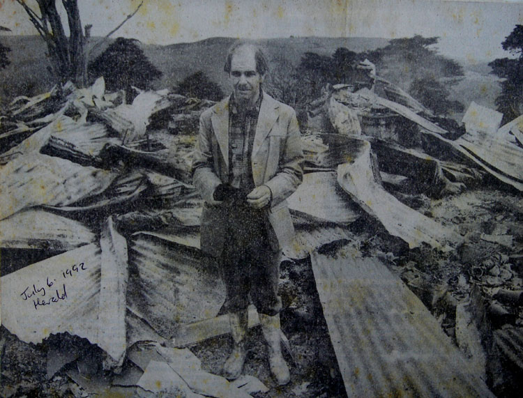
Allan Titford standing in the ruins of his farm home at
Maunganui Bluff in 1992, the second to be burnt to the ground by (????)*.
By this point in time Allan and Susan Titford had been constantly terrorised
for five years and the New Zealand government stood back and let it all
happen or worked in collusion with the activists. Because
of deliberate distortions of the Treaty of Waitangi between 1975 and 1992
or thereafter, up until the present, white New Zealanders were left defenseless
by a government whose sworn duty it was to protect them and their freehold
titles under the Treaty of Waitangi. The government
of New Zealand are not only in breach of Allan & Susan Titford's
guaranteed
Treaty of Waitangi rights, but are
also in breach of The United Nations Universal
Declaration of Human Rights 1948, Articles: 1, 2, 3, 5, 6, 7,
8, 9, 10, 11, 12, 16 17, 21 23 and Article 30 or sections within all of
the above. Well-documented incidents can be cited to support this contention.
See SUBMISSION
* Footnote: Due
to an organised smear campaign (November 2013) Titiford is now accused
of burning down his own home to gain, "public sympathy". The nonsense
that Allan Titford burnt down his own home and the valuable, irreplaceable
Bohemian heirlooms of his settler family, as well as all of his hard-won
historical records, is just too big a lie to swallow.
His house insurance had been cancelled and, besides, Prime Minister David
Lange had issued an edict that “no private land would ever be lost
to a Maori land claim”. Titford had absolutely no reason under the
sun to burn down his own house for something as stupid as gaining “public
sympathy”, but it certainly provided the police with a much-wanted,
immediate opportunity to kick the Titfords off the property.
The government agency extortionist racketeers, intent upon getting
some semblance of a sale agreement that they could make stick, had to falsify
the "Deed of Settlement" papers. The coercion applied, by
strong-arm, stand-over tactics, was illegal under the "Land Transfer
Act 1952" (& 1948). It was also highly illegal under the "Contractual
Enforcement Act 1956", due to the falsification of the Deed of
Settlement papers, shoved through with Allan Titford's written conditions
and protests deleted. This illegal tampering
with sale documents was so serious that the government refused, for almost
fifteen years, to make the papers available, until finally sourced under the
"Official Information Act 1987" (unobtainable until the 1st
of November, 2006). The Crown would not even supply Allan Titford's nominated
lawyer, Mr Clive Jackson of Jackson-Whittaker in Auckland with
a copy of the Sale Agreement or Deed before or after the settlement. In fact,
neither Mr Jackson, nor Mr Titford ever received a copy of the executed Sale
Agreement or Deed from the Crown in the many years that followed, despite
ongoing requests. Lawyer, Mr. Clive Jackson was refused a copy on the grounds,
"the documentation was confidential".
This
deliberate falsification of Deed & Sale documents, by subordinate Government
employees, is particularly despicable for the following reasons:
- Before "Title" could be transferred
from Allan Titford to the "Her Majesty the Queen" the documentation
had to be subjected to "Parliamentary Review".
- Documentation supplied to Parliament, by subordinate
officials, had been deliberately tampered with to remove Allan Titford's notations
or conditions indicating that he was "signing under duress"
and that he did not accept that the arguments presented, as to why he should
forfeit his farms and assets, were valid.
- Allan Titford did not
accept that the price being paid was fair, as it had been determined solely
and illegally by "government valuers" only and the "correct
market value", as arrived at by of his own "independent valuers",
had been disallowed (in breach of the Acts of 1948 & 1952).
- The notations indicated that this was not a "Willing
Seller- Willing Buyer" transaction, but instead was a "forced
sale under duress" (illegal under the Act).
- When the government came back to Allan with a much
reduced offer from an earlier offer, he refused to sign the Deed
of Transfer until conditions at least equal to the previous
offer and closer to real, independant valuations were met. Some government
functionary then FORGED Titford's
signature on the Deed of Transfer and, to his complete
astonishment, he heard through the media that the farm had been acquired by
the government. Both he and his lawyer were subsequently refused copies of
the "Sale Agreement" papers. and he was unable
to access them for 12-years thereafter. The many "versions"
of papers, which he finally was able to get in dribs and
drabs through multiple Official Information Act
requests, had been severely tampered with and altered by government employees.
- It became glaringly apparentt that Allan Titford's
lawyer, Clive Jackson, had been refused the papers solely because they had
been radically & illegally "tampered with", including
Titford's forged signature on the transfer deed.
- Parliament, because of "falsification of the
true facts" and "Sale Agreement" documents
by subordinates, was not supplied with correct information, sufficient to
arrive at an informed decision in behalf of Her
Majesty the Queen. The deceptive, forced acquisition of the
Titford assets, using unfair "blackmailing or extortion tactics",
FORGERY and other "dirty
tricks", all done in the name of the
Queen, lacked essential integrity. Therefore, any path
leading to "Royal Assent" in this decision making process,
was strewn with falsehoods, not made clear or even available to Parliament.
- Given the circumstances, the lands and assets in question
must automatically revert to the ownership of Allan Titford, as significant
tampering with the content of partially signed and notated documents occurred
between the time they left Allan Titford's possession and when they were presented
to Parliament. The avowed purpose, in the presentation of these documents
before Parliament, was to ascertain that all of the legalities, leading to
the correct transfer of "Title", had been satisfied in accordance
with the Acts. Titford's supposed signature that Parliamentarians saw on
on the transfer deed was a forgery by a government employee.
The one insurmountable, blackmailing tactic the Titfords couldn't
overcome or fight, leading to this "forced signing" of some
final papers pending a full sale agreement, was the very real threat
that Allan Titford's parents, as guarantors and consignees to the Maunganui
Bluff farm purchase, being forced by the government to lose
their Waiwera family farm of four generations ownership. This was the gun-at-the-head
"offer he couldn't refuse", proposed by the government's
sinister "Mr. fix-it" henchman, Ray Chappel.
The Mafia Godfather,
Don Corelone, couldn't have done it better.
The New Zealand
public have no idea of the wear-you-down, strong-arm tactics that went on behind
the scenes in this case and Ray Chappel, the government's, extortionist expert,
even boasted how "we own the media and can manipulate public perceptions
of you". He also, in smug confidence, told the Titford's that the background
history to the Te Roroa claim against the Maunganui Bluff farm property was "so
complex, with the true documentation so well-hidden, that they'd never be able
to work it out and raise a counter-case".
The miserable old henchman still dutifully shuffles around the
corridors of Bowen House, Parliament, forever engaged, undoubtedly, in the
government's "special work", for which he has considerable
talent. He once boasted to Allan Titford that 'he's never failed in getting
what he wants and had worked under six prime ministers'. He further stated,
'It doesn't matter how good your case is or how much evidence you find,
because we own the judges and you'll never get anywhere'. He cautioned
Allan Titford strongly, not to 'fart on the church pew', in other words,
don't make a big stink or unwelcome, unholy noise in public, 'or we'll
punish you forever throughout your life.
Chappel stated that the only right Allan had under the Treaty
of Waitangi was the right to 'be in the county'. He said that 'the
Treaty was between the Maoris and the Crown', meaning 'government representatives
such as himself'. He told Allan Titford that the farm 'didn't belong
to him anyway, as the mortgage was held by the Rural Bank (of which Chappel
was formerly a top director) and the land is now a 'Historic Place'. This
latest little devious wrinkle was due to the "dirty tricks department"
of DOC and Historic Places Trust "suddenly finding" evidence
of "middens" and declaring a "wahi-tapu"*, after
claimants were seen carrying in buckets containing shells and burnt rocks
to dump in spots along the newly bulldozed road that Allan had just put in
for his coastal subdivision.
*Note:.
The ever-creative "dirty tricks" department used the excuse that
there were Maori burial sites in the same area where the claimants were observed
to be bringing in bucket loads of burnt rocks and shells. The only known graves
in the recorded history of the area were those of six French sailors from the
L' Alcemene shipwreck of 1851, which remains were removed before W.W.II for reinterrement
at another cemetery. The former grave is now covered by a house of Aranga Township
on the sea coast.
So, to Political Scientists around the world studying how "Democracy"
works in New Zealand, the Titford case gives you a perfect sample of how the
New Zealand Government deals with the majority of it's citizens:
It's a totalitarian regime, only
feigning or giving the illusion of democratic rule, but not the least averse
to using dirty tricks, intimidation and strong-arm tactics to get what it
wants. Our government departments and institutions have been largely infiltrated,
occupied or hijacked by Maori activists and supremacists, whose working philosophy
is guided by manufactured, "grievance-based", Marxist pseudo-history.
The country has major problems.
The Titford's
however, by sheer bloody mindedness borne of anger over the injustices meted out
to them; wounded pride over the unwarranted character assassination insults, accusations
and demeaning propaganda levelled at them in the whore media; righteous indignation
for the treachery of multiple government departments or officials who should have
protected them but didn't; they searched relentlessly in both the Australia and
New Zealand for documents pertinent to their case. Bit-by-bit, over time, they
found and pieced together all that they needed to reconstruct the true history
and prove that they had always held a legal, indisputable title to their farms
at Maunganui Bluff.. The reams of true historical documentation accrued prove
conclusively that Te Roroa claim Wai 38 is a very transparent fraud. It
proves that deliberately doctored, very selective and distorted historical information
was, for the sole purpose of acquiring assets under false pretences. The prostituted
Hooker-history submitted to the Waitangi Tribunal by the Te Roroa claimants or
that of "premeditated-outcome" historian-lawyers and spin-doctors from
Crown Law and Historic Places, effectively rendered null & void,
the legal titles covering the Titford and Harrison farm properties.
This
was a gross travesty of justice, which has too long been allowed to persist, despite
the huge body of new, documented evidence, relative to the case, having been presented
by the Titfords to the government. This ugly blotch on the government's record,
in singling out, bullying and terrorising an innocent young farming couple into
subjection, will never go away or be satisfied by token compromises after the
event or deceitful statements of justification now being proffered such as, "willing
seller-willing buyer". The Titfords were never willing sellers and it
was very much a forced sale by a couple that the government deliberately bankrupted
into submission, according to a premeditated plan of interdepartmental co-operation.
As stated, several very influential and active government department heads, engaged
in opposing the Titfords, were also Te Roroa claimants or closely related family
to the claimants, with a vested interest in the outcome.
There
has been ongoing criminal negligence by ministers of the Crown and dereliction
of duty by successive governments on this issue, which lapses in responsibility
must be fully and finally addressed in an open and honest public forum. The case
must be reopened and all New Zealanders must be granted full disclosure of the
true, cross-examined facts in order that justice is seen to be done and the ongoing
vexation laid to rest permanently. Public confidence in the government needs to
be restored on this matter, as negative feelings of incompetence or unfair tampering
by elected officials are the overriding perceptions. Too many New Zealanders know
the facts of this case and the issue will fester and cause problems for all the
years to come, unless corrected.
To clearly establish who the
true Maori owners were of the Titford and Harrison farm properties in 1876, and
whose right it was to sell the huge Maunganui and Waipoua blocks to the Crown,
one needs to review the history of Maori wars and conquests, going back into the
1700's and before. One also needs to review the agreements and "trade-offs"
entered into by the owners and part-owners in 1875-1876.
Here
is the true history that Nathan cabal, Minister of Propaganda
and self-serving pseudo-historian, Gary Hooker, omits to mention.
- By
1875 it was essential to establish ownership of lands on the Northern West Coast
of New Zealand, situated between the Hokianga Harbour and extending down to the
Kaiiwi Lakes, south of Maunganui Bluff. The final contending parties were Parore
Te Awha (considered to be Ngapuhi) and supported by Ngapuhi and Tiopira Kinaki
(Te Roroa ), supported by Te Roroa and Ngati Whatua. All parties were claiming
the areas based upon occupation, ancestry and conquest. Both Parore and Tiopira
mentioned a right to these areas via a lineage back to Toa of Ngatiwhatua or to
subsequent ancestors who inherited areas within the region following the epoch
of Toa and Ngatiu of Western Ngapuhi.
- Toa, by the late 1600's,
had control of lands from the Hokianga Heads to Waikaraka on the north side of
Maunganui Bluff. Additional historical accounts speak of his lands extending all
the way down to the Northern Kaipara harbour. His holdings at Waimamaku and Wairau
were given to the children of his first wife, Waitarehu of Te Roroa, formerly
from Waimamaku. His interests in the lands of Waipoua, extending through the Waipoua
Forest to Waikaraka (Maunganui Bluff boundary and beyond to the Northern Kaipara),
were given to his third wife Te Hei of Ngati Ruanui, formerly from Whangape. His
second wife had no children.
- Contemporary to the time of Toa,
a blind man of great importance named Pinea was buried alive atop Maunganui Bluff,
as his people were tired of carrying him around. His mission, in death, was keep
watch over the vast lands extending southward to the Northern Wairoa. His mother,
Wareiahunga and also his wife, Takutaiakura, were of o Ngati Rangi, who had arrived
in about 1300 AD had taken the land from the original people. Pinea was the father
of the five hapus of Ngati Whatua, who mostly settled the Kaipara district. Te
Roroa gained some links to Pinea through the marriage of Tarawanoa (f) to Rongo
of Ngati Rongo hapu from Ngati Whatua. He was the son of Haumoearangi of Kaipara.
Haumaoerangi, in turn, was the chief living on Mt. Wesley (Dargaville) in 1600).
The Ngati Rangi had come on the Mamari canoe and had landed at Omamari in 1300
AD. The ancestors of Haumoearangi were dropped off the Mahuhu-te-rangi canoe in
the Kaipara and displaced the original people. The canoe returned to the far north
and the ancestors of Toa moved, over several generations, progressing southward
through the Hokianga and by 1500 were found in the South Hokianga from Waimamaku
to the Waipoua.
- Two generations after Toa in about 1760 AD, Taramainuku,
inherited further rights to lands extending from Maunganui Bluff and Tutamoe Mountains
to the Wairoa River at Dargaville. He received this territory from his half sister
Teheru of another mother from o Ngati Rangi. Taramainuku, in turn, was the grandfather
of Parore Te Awha (considered to be Ngapuhi by the 1870's) who featured prominently
in land sales at Maunganui and Waipoua in the mid 1870's.
- One
historical account speaks of a 1793 Ngati Whatua attack on Ngapuhi proper at Pakatona.
- In
about 1795 the Te Roroa hapu (descedents of Toa's first wife Waitarehu) were attacked
by the forces of Western Ngapuhi chief Rori at Ponaharakeke, near Waimamaku, south
of the Hokianga harbour, and defeated there. Te Roroa refugees fled south onto
their Wairau block. The conquerors remained at Waimamaku for about a decade before
returning to their lands to the north. Chief Rori was an ancestor of Wi Pou of
Ngaitu, who featured prominently in the Waipoua and Maunganui block sales to the
Crown in 1875-76.
- According to evidence presented
by Tiopira Kinaki in 1875, (Northern
Minute Book 2, page 207 - 208, concerning Case of Waimamaku, Wednesday 16th June 1875) after Te Roroa warriors subjected some
of Rori's captured fishermen to torture and indignity at Kawerau, south of Waipoua,
Rori devised a cunning plan to lure Te Roroa forces from their new-found stronghold
at Wairarapa PA. Again, Te Roroa were soundly defeated, with three of their primary
chiefs killed.
- Depending on blood links, Te Roroa refugees went
onto land owned by the descendants of Toa's third wife Te Hei. By this time there
were approximately 3 generations of Te Hei's lineage, who had married Ngapuhi
proper women and the Te Roroa refugees were becoming distant cousins, as their
blood links had remained within their own group.
- The dispossessed Te Roroa survivors of Rori's
raids had to settle at wherever sanctuaries they could find on the lands of other
hapus, to which they were distantly related. Some had fled to Opanake (what's
known as Kaihu Valley today), about 15-miles Southeast of Maunganui Bluff or beyond
to the south and attempted to live there.
- At about the year 1800
an old Te Roroa woman called Kahukore, sent her son, Taoho to plead with chief
Kukupa that he might be allowed live in peace at Kaihu until he died. Kukupa consented.
Amongst the defeated Te Roroa people given permission to live, as squatters, at
Kaihu were these ancestors of Tiopira Kinaki, who many years later in the mid-1870's,
featured prominently as a vexation and troublemaker, interfering in the affairs
and attempting to use the British legal system to steal the possessions of chief
Parore Te Awha at Maunganui Bluff and Waipoua.
- After a few years
Taoho, living with Kukupa's permission as a squatter at Kaihu, felt confident
enough set up a "rahui", or boundary marked reserve, immediately south
of Maunganui Bluff, prohibiting the true owners from entering the land there.
Chief Te Awha and Kukupa, along with their forces, went south from the Waipoua
and destroyed the Te Roroa plantations. They also cut down the illegal rahui boundary
marker pole of the Te Roroa land-grabbing thieves.
Almost
two hundred years later, in 1988, Allan Titford, was forced to repeat this same
act of cutting down a false rahui placed on his land. A rabble of "born again"
Greek Maoris, led by Alex and Manos Nathan, concocted a false claim over the Titford
farm. Earlier, Ned Nathan, in collusion with the newly empowered Waitangi Tribunal
upon which he often sat* created a body of fraudulent history for the express
purpose of forcing the government to steal the land from the Titfords. The modern
day cabal of thieves, most with only a minute trace of Te Roroa lineage, if any,
placed an illegal Powhenua (rahui boundary marker pole) called Pinea (which
in their twisted sense of humour was made of pine...a non-New Zealand wood species...Pinus
Radiata) on Allan Titford's fully titled Maunganui Bluff property. Although
a half Greek (Cretan) himself, with diluted down Maori ancestry, Manios Nathan,
carver of the Powhenua, placed his rahui pole in the same
general vicinity where Taoho of Te Roroa had placed his almost 200-years previously.
The Nathan [Patuawa] family had a long record of trying to get this land
for nothing, extending back to Wi Natana, son of Natana Patuawa (Nathan Porto-ava).
At the time Wi Natana made his first attempt to claim land at Maunganui Bluff
[circa 1900] he had no known blood affiliation to the Te Roroa hapu at all and
the land had been under full Crown ownership for a quarter of a century. It would
appear that his mother, Tarati, was Ngapuhi, but others say she was Ngati Whatua.
Wi Natana's claim was refuted out of hand as ridiculous by the Succession Claims
Court.
*(See, for example Claim Wai 10, the Waiheke Island claim, brought
by Hariata Gordon for Ngati Paoa on 8 March 1985, in which Ned Nathan participated).
The
angry reaction by Te Awha and Kukupa caused the somewhat humbled, Taoho to go
to the Waipoua to plead with Te Awha, who told him in no uncertain terms that
Te Roroa hapu had no possession of land to the south at Maunganui Bluff or the
Kaihu Valley. They were living there only as guests or squatters, whose former
conquered lands were at Waimamaku. Chief Te Awha was the father of Parore Te Awha,
who later featured prominently in the sale of the Maunganui block to the Crown.
This attempt by Taoho to steal the land of Te Awha was the beginning of lingering
resentment that festered and caused conflict throughout ensuing generations.
- Historical
documents show that at one point the Ngaitu hapu of Western Ngapuhi, came down
from Whangape and occupied Waimamaku, with some of that hapu setting up residence
in the Kaihu Valley and later having major disputations with the Te Roroa hapu
in residence there.
- In about 1805 Chief Pokaia of Ngapuhi, who
was also the uncle of Hone Heke*, came down to visit Parore at Waipoua, while
the Te Roroa exiles were living there. During the visit, word came up from Otamatea
to Te Roroa chief Taoho that adultery had been committed when the wife of Pinaki,
son of Te Toko, had been seduced by one of the Ngati whatua men. This was a grave
insult, for which Te Toko called upon chief Taoho and Te Roroa for assistance
in dispensing retribution at Uri-O-Hau PA. Ngapuhi chief Pokaia and his party
were invited to witness the proceedings and punishment of chief Te Hekeua and
his people for the offence. Te Roroa organised a war party and chief Pokaia of
Ngapuhi proper, along with his party, accompanied them south to Otamatea as observers
and non-combatants.
*Hone Heke was the son of Kau (brother of the chief Pokaia),
and of Tupanapana. He was a nephew of Hongi Hika.
- Unbeknown to
chief Pokaia of Ngapuhi, he was being lured into a trap and was to become the
victim of treachery, for, upon arrival at Te Hekeua's PA, Te Toko and Taoho were
summonsed, by signals back and forth, to enter peacefully into the PA of their
kinsfolk, while chief Pokaia and his party were forbidden to enter, but left unprotected
outside. Te Hekeua and his warriors then attacked Pokaia's party, and Te Hekeua
slew Te Tao, Pokaia's son. This was the terrible price Pokaia paid for agreeing
to come and be a witness in the quarrel of others. Chief Pokaia now had a deeply
personal take or cause against the Uri-O-Hau tribe and chief Te
Hekeua in particular, for which he demanded vengeance be satisfied by chief Taoho
of Te Roroa, who had lured him and his party to this place of danger. This is
the actual incident that started the "Musket Wars".
- Pokaia
took the body of his son north to Opanake where present-day Kaihu township is
located and buried him there. Before returning to Kaikohe, Pokaia admonished Taoho
to seek revenge for "our son" (ta taua tamaiti). He returned to Opanake one year later to exhume the bones of his son, in
order to convey the remains back to his people for the tangi ceremony. Pokaia
now learnt that Taoho had taken no steps to avenge Te Tao's death and consequently,
his take now turned against the Taoho and his section of the Te
Roroa hapu and assumed such proportions that he was obliged, by Maori "utu"
custom, to avenge the murder of his son. Soon after arriving home with Te Tao's
bones, other contributing events occurred, which brought Pokaia's feeling of retribution
to a head and sealed the impending fate of the treacherous Te Roroa.
- At
around this time [1806] Pokaia resolved to attack Te Roroa. He, therefore took
the wife and children of Tore-tumua-te-Awha (Parore Te Awha's father), to whom
he was related, to Manga-Kahia, south of Kaikohe in order to save their lives
from the impending war that was nigh at hand.
- Modern-day Te Roroa
commentators, basing their statements on those of disgruntled Te Rore Taoho, son
of Taoho (whose version of history was recorded nearly a century later in 1898
after his opposition had died off), claim that Te Roroa drove Tara-mai-nuku (the
grandfather of Parore Te Awha) from his home at Waipoua. The Te Roroa raiders
were under the leadership of Te Waiata (father of Taoho) and it is claimed that
they occupied Tara-mai-nuku's lands at Waipoua and Kaihu. Modern opportunist Te
Roroa commentators state that Tara-mai-nuku and his people, once ousted from Waipoua,
attempted to settle on their lands at Kaihu. They state that Te Waiata attacked
them there as well and defeated Tara-mai-nuku's forces in the battle of Wai-tata-nui
on the Kaihu mountain beyond the Kaihu block. Te Roroa commentators go on to claim
that Tara-mai-nuku and other survivors fled south, abandoning their lands completely
to the possession of Te Roroa conquerors. There is no documentation by anyone
else, other than Te Roroa, that any of Parore's people or those of his grandfather,
Tara-mai-nuku, were killed in this alleged conquest of their lands by Te Roroa.
To the contrary, all the evidence shows Te Roroa were driven into exile.
- Much of Te Rore Taoho's biased account was disputed by Ngapuhi historical
commentators, who stated that the land was never abandoned and that Ngapuhi warriors
remained steadfastly in place at Kaihu, only evacuating their women and children
to Kaikohe temporarily for their physical safety. A close scrutiny of historical
documents gives no support to Te Roroa's version of events, and it's quite evident
that Tara-mai-nuku, supported by Ngapuhi, was never forced to abandon his holdings
at Waipoua or the Kaihu Valley.
- Another
contributing incident to the coming vengeance by Pokaia occurred, wherein a Ngapuhi
woman was murdered at Waituna, near Waimamaku, through the instigation of, or
with the knowledge of, Te Hekeumu (Uri-o-Hau) and Te Toko (Te Roroa). The
stage was set for major reprisals from Ngapuhi and a preliminary skirmish took
place at Waituna. In this battle Ngapuhi chief Eruera Patuone, of Ngati Hao at
Hokianga, killed Te Roroa chief Tataka-hui-nui. Until the murderous incident involving
the Ngapuhi woman the chiefs of Western Ngapuhi had not been in conflict with
Uri-o-Hau.
- After these events, Pokaia went south in 1806 and fell
upon a small Te Roroa PA at Whakatau, near Maropui, taking the inhabitants completely
by surprise, slaughtering them en-mass and later feasting on their corpses. This
location was just east of the Kaiiwi Lakes in the upper Kaihu Valley and constituted
the first overt act of revenge by Pokaia of Ngapuhi upon Taoho's Te Roroa hapu
for their treachery. In revenge for this attack and slaughter, Ngati Whatua, who
were somewhat related and allies to Te Roroa, took up arms to fight Ngapuhi. Te
Roroa were now split into two separate camps, as some cousins had remained around
Waimamaku if blood links to Ngapuhi had been sufficiently strong to ensure their
safety. More distant kin had been forced to flee south to Taoho's hapu and all
were now being chased into Ngati-Whatua territory..
- In 1806 Ngati-Whatua chief, Muru-paenga, raised a war party that travelled
north from Kaukapakapa, by canoes, proceeding up the sea coast and Wairoa river
to attack Ngapuhi settlements at Mata-raua, there conquering the PA at Te Tuhuna.
This war party later attacked Tai-a-mai,
near Kaikohe, dangerously close to the home of Pokaia himself, and were equally
successful in dispensing death to Ngapuhi there also.
- In revenge
for these attacks and the bruising of Ngapuhi's pride in their heartland, Pokaia
turned his attention to Taoho's PA, Te Kawau, at Kaihu, which he successfully
overwhelmed, causing Te Roroa survivors to flee a little further south to retrench
in another stronghold.
- The
battles of 1806 raged on, with Pokaia determined to kill chief Taoho of Te Roroa.
Pokaia attacked the Te Roroa PA named Tirotiro, situated in the Kaihu Valley and
very close to where Taoho was living. Up until this point Taoho had taken little
notice of the killing of his people, stating,'Let Pokaia take payment for the
death of his son', but finding that Pokaia seemed determined to push revenge
to the extreme, came to the conclusion that he could be the next victim. He, therefore,
abandoned his settlement at Opanake in the Kaihu Valley and fled to Te Puka on
the Wairoa River. Pokaia and his warriors followed him there and attacked, but
were repulsed. Taoho fled once again, this time to Arapohue.
- Taoho
and his warriors entrenched themselves for defense at Te Aratapu-a-mania,
south of present day Dargaville. Pokaia's forces attacked, but were repulsed again.
Taoho again fled further south, this time to Tiki-nui and Tokatoka. On these high
rock upthrust and bluff areas, adjacent to the Wairoa River estuary, Taoho had
sufficient time to set up more substantial defensive positions. Pokaia's forces,
which seemed to have retired for a time after the battle of Arapohue, came
down to attack Taoho's forces once again. Accompanying Pokaia on this occasion
was Hongi Hika, who is generally blamed for the terrible "Musket Wars",
which were started, in fact, by Taoho's treachery*,
leading to the murder of chief Pokaia's son Te Tao and follow-on indignities suffered
by Ngapuhi at the hands of Te Roroa and Ngati-Whatua invaders. Joining Pokaia
at the battles of Tiki-nui and Tokatoka were the Ngapuhi subtribes of Ngati-Korokoro, Ngati-Manu, and
Te Hikutu of Whirinaki, seemingly anxious to avenge the recent deaths of
their people at Waituna.
*Note: This treachery by Taoho was the real cause
of the terrible Musket Wars of inter-tribal fighting, which raged for about twenty
years between 1817 onwards and might have affected as many as 60,000 Maori, killed,
maimed or enslaved.
- Because Taoho and his forces were so well
entrenched on the high ground at or near Toka Toka, the battles were fairly indecisive,
with both sides claiming victory. The fact of the matter was, however, that the
Te Roroa people under Taoho's leadership were now in exile, fully driven from,
and unable to return to the lands in the north that they had occupied in recent
years
. - It is important to note that, in the case of Parore Te Awha,
who later featured very prominently in the sale of the Maunganui Block to the
Crown in 1876, his genealogy shows direct lineage to "Tino-Ariki",
Rahiri and by consequence to both Pokaia (uncle of Hone Heke) and Hongi Hika (who
won the "Musket Wars" started by Te Roroa and Ngati-whatua). Hongi Hika
also meted out "utu" or revenge against other tribes, including Ngati
Porou and Ngati Te Rangi of East Cape and Tauranga. These tribes had eaten Ngapuhi
princesses and other Ngapuhi people who had gone with the convicts on the Brig
Venus, stolen in Tasmania, Australia and sailed to New Zealand in 1806 by the
fugitives from justice. The Ngapuhi people, later murdered and cannibalised by
the East Coast tribes, included relatives of Hongi Hika.
- It
would appear that in 1806 Ngapuhi, under the war leadership of Pokaia, withdrew
from fighting Taoho at Tikinui for a time, but it's uncertain that he withdrew
from the district completely, although that distinct impression seems to have
been concluded by chief Taoho. It would appear that secreted Ngapuhi observers
might have witnessed Taoho and his men leaving the PA to go on a fishing expedition
to the West Coast of Poutu Peninsula as, with Taoho and his warriors absent, Ngapuhi
attacked and overwhelmed the PA. After Pokaia's forces had killed most of the
unprotected women and children they retired towards Maunganui Bluff.
- Thereafter,
Taoho moved to the high prominent point of Tokatoka for defense and dwelt there
where his observers could watch for enemy movements over a vast distance. He again
ventured out on an expedition to gather Toheroa shellfish on the West Coast and
was met by a small war party of allies from Ngati-Kawa, a subtribe of Te Uri-O-Hau,
under the leadership of Te Pona. They were en route to attack Ngapuhi at Maunganui
Bluff. Te Pona's war party proceeded north along the coast to Pa-hakehake, but
were detected by alert Ngapuhi sentries under the leadership of Te Kahakaha. Te
Pona's war party were attacked in the moonlight and, seemingly, taken by surprise,
for about thirty of them were killed by Ngapuhi warriors, including, it seems,
Wai-tarehu of the Te Roroa hapu. The location of this battle was north of Moremo-nui
on the coast. A few of Te Pona's warriors escaped to carry back news of the defeat.
Ngapuhi chiefs Te Kahakaha and Te Kairua were then living permanently at Maunganui
Bluff and continued to do so until the time of the "peace deal" wherein
Taoho was allowed to return and live under Parore's protection in 1824. Later,
Ngapuhi chiefs Te Kahakaha and Te Kairuawhen moved back to Punakatere near Kaikohe,
being ancestors to Wi Pou who later featured prominently in the sale of lands
around Maunganui Bluff to the Crown in the 1870's.
- An ambuscade
befell Ngapuhi in 1807, that would have very serious consequences on Te Roroa
and Ngati Whatua in years to follow, due to the deep resentment, arising from
this incident, festering forevermore in the heart of Hongi Hika of Ngapuhi.. A
war party of Ngapuhi warriors, seemingly from Kaikohe and led by Pokaia, ventured
southward to invade Ngati Whatua territories in the Southern Kaipara district.
Their movements were detected, however by forward guards of Te Roroa, watching
for the enemy. Smoke was seen to be rising at Maunganui by watchers at Taoho's
elevated PA at Tokatoka. Taoho soon knew that the south side of Maunganui Bluff
was occupied by a large number of Ngapuhi, due to the glow of the fire at night.
- Taoho relayed a signal or messengers were despatched directly
to chief Muru-paenga of Ngati Rongo, one of the hapus of Ngati Whatua. He acted
quickly, summonsing his warriors to depart by canoes across the Kaipara for the
Wairoa River. They were accompanied north by Ngati Whatua proper or the main tribal
body from Otakanini at South Head under the leadership of chief Te Wana-a-riri.
The South Head PA was situated 29.25 miles SSE of Tokatoka and the Wairoa river,
flowing into the Kaipara Harbour, passed immediately adjacent to Tokatoka PA where
Taoho was ensconced. The Ngapuhi warriors coming down from the north assembled
on the southern side of Maunganui Bluff about 30-miles to the N.E. of Tokatoka.
- Scouts of Te Roroa were sent off, who ascertained that Ngapuhi were now
in force on the south side of Maunganui Bluff at the settlement where Te Kaha and Te Kairua of Ngapuhi lived. One
of the scouts clandestinely penetrated the camp by night, and moving quietly about,
learning that Ngapuhi intended to move on the next night to Moremo-nui, twelve
miles down the coast and camp there, as it was the only place along the
coast where there was a sufficiently large opening in the cliffs to admit so numerous
a war party. Whilst making his way out of camp the scout secured a basket of kao,
or dried kumaras, and hastening back through the
night, brought it to chief Taoho of Te Roroa, combined with the taua
of Ngati-Whatua and Te Uri-o-Hau. The basket of kao was visible proof of
the story he had to tell. An immediate advance on Moremo-nui to the north was
decided on by Muru-paenga (of Ngati-rongo hapu) and Taoho, (of Te Roroa hapu) and before night the
force was lying in wait to ambush Pokaia and his warriors.
- Moremo-nui
is a little stream which, after passing, through the sand-dunes on top of the
red clay cliffs, falls into the sea about twelve miles south of Maunganui Bluff.
The perpendicular cliffs are here about 150 feet high, and below them lies the
long, straight, hard, sandy beach of Ripiro, which extends in one direct line
for fifty-two miles from Maunganui Bluff to Kaipara Heads.
The little valley in which the stream runs is clothed in flax and toetoe, which afforded shelter to the Ngati-Whatua
host, as it awaited the coming of Ngapuhi.
- Before
dawn the Ngati-Whatua host partook of a hasty meal, and not long afterwards, just
at the break of new day, the Ngapuhi army appeared, and, not suspecting the proximity
of their opponents, at once took off their belts, laid down their weapons and
proceeded to prepare a morning meal. Whilst eating they were suddenly
attacked by Ngati-Whatua, who had been laying in wait,
and for a time a great scene of confusion ensued, as warriors rushed here
and there to secure their weapons. Ngati-Whatua soon drove them to the open beach,
where an obstinate fight took place, lasting for some time, as success first favoured
one party, then the other. The Ngapuhi guns stood them in good stead, for Ngati-Whatua
had none.
- Eventually the Ngati-Whatua- Te Roroa alliance,
incited thereto by chiefs Muru-paenga and Taoho, closed on their enemies
with a rush, and during the melee, Pokaia of Ngapuhi, uncle to Hone Heke, received
a deathblow from a mere at the hands of Taoho. Ngapuhi were panic-stricken at the death
of their leader, and commenced to flee. At this juncture, Taoho directed Teke,
an Uri-o-Hau chief, to get close up to the retreating Ngapuhi, and with his weapon,
draw a deep line on the sandy beach, being the MARKING OF
THE SANDS, beyond which none of the Ngati-Whatua taua
were to pass in chase. Ngapuhi lost some great chiefs, amongst whom were Pokaia (the leader), Te
Waikeri, Tu-Karawa, Tohi, Hou-awe, Te Hau-moka and others. A great Rangitira was
also killed, whilst the celebrated Hongi-Hika only escaped by his fleetness of
foot. Ngapuhi later acknowledged that one hundred and fifty of their number were
lost . Maning
says three hundred, Carleton two hundred, and that one hundred and seventy heads
were stuck up on poles of the five hundred that composed the Ngapuhi
taua. Chief Taoho received a fairly severe wound to the mouth and neck in
this battle, but survived.
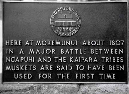
The
memorial plaque at Moremo-nui, commemorating this battle twelve miles south of
Maunganui Bluff on the beach of the West Coast. Although
this battle took place at Moremo-nui, it is generally called Te Kai-a-te-karoro
(the seagull's feast), because the dead were so numerous that they could not
all be eaten by the victors, and hence were left for the seagulls. Another name for it is Te
Haenga-o-te-one (the marking of the sand), from the line drawn by
Teke (of Uri-o-Hau) to stop the pursuit.
(19th Century Maori Wars page 48)
Note: This event, called "Marking
of the Sands" (Te
Haenga-o-te-one) is very important, as it is why
Te Roroa, under Taoho, continued to live in exile on the Kaipara, until a delicate
peace was negotiated in about 1824. As
a result of "asked-for" assistance by Taoho to chiefs Te Kairau and
Te Kaha, who had been living at Maunganui Bluff. Taoho was allowed to return from
exile and live eight miles south of Maunganui Bluff at Te Mamari. Chiefs Te Kairau
and Te Kaha arranged for Taoho to meet safely with Hongi Hika at Kerikeri to negotiate
a peaceful return from 20-years of exile. Taoho and his people, thereafter, were
allowed to live as tolerated guests, under Parores protection in the upper Kaihu
Valley at Opanake, this being just before the battle of Ikaaranganui in 1825,
wherein Hongi Hika's forces finally decimated Ngati Whatua.
- Ngapuhi
warriors returned home after this defeat, but two of their Western Ngapuhi chiefs,
Te Kairau and Te Kaha remained steadfastly in place, as they had previously set
up permanent residence at Maunganui Bluff as a forward guard position to any incursions
up the West Coast by Ngati Whatua or Te Roroa. For several years thereafter there
were raids back and forth, with Te Roroa forces coming north to do battle, but
inevitably returning to the land of their exile in the Kaipara.
- In
1808, Ngati-Whatua, emboldened by their victory ambush at Moremonui, ventured
north to attack the Ngati-Korokoro
settlement at Wai-o-te-marama,
situated near Waimamaku. Hongi Hika was present at this battle, which was won
by Ngati-Whatua. Ngati Korokoro did a reprisal attack on Ngati-Whatua in the same
year.
- In 1810 Ngati-Whatua came north again and attacked
the Mahurehure division of Ngapuhi, killing many
men in the process. It is said that the slaughter was so great on this occasion
that he bodies of the fallen clogged the stream where the battle took place. In
the process of returning home from this battle Ngati-Whatua came across unattended
Ngati Korokoro canoes and stole them, then deceptively slaughtered the women and
children occupants of the Opara village at the mouth of the Whirinaki River, who
had thought their own menfolk were returning and had bid them welcome.
In
about 1813, Hongi Hika attacked Whiria PA on the southern side of the Hokianga,
where chief Tuohu (grandfather of Tiopia Kinaki) was ensconced. Hongi had a score
to settle with Tuohu, who had helped devour Ngapuhi warriors after the battle
of Moremonui. While Hongi was engaged in this battle, at which he was repulsed,
he had left his PA (Pakinga) at Kaikohe undefended and Tuohu managed to sneak
out undetected and lead raiders against Hongi's PA, while under siege himself,
killing many of the defenceless women and children there at Pakinga. Hongi was
unsuccessful at Whiria and, while returning home, received word that his own PA
had been decimated in his absence.
Hongi
Hika therefore returned immediately to Hokianga and was successful in overwhelming
Te Tihi's PA in lower Waihou, killing Te Tihi himself with a horse pistol. This
confrontation brought with it a cessation of Eastern Ngapuhi attacking Western
Ngapuhi. It is well known that the killing of Te Tihi later led Eruera Patuone,
his brother Tamati Waka Néné and Mohi Tawhai to support the Crown
and negotiate the Treaty of Waitangi, then oppose Hone Heke's rebellion in 1845.
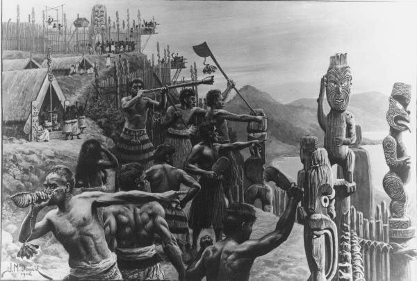
Maori
defenders sound trumpets to alert their people of an imminent attack by the enemy.
Picture by McDonald, James Ingram, 1865-1935 : Alarm in a Ma-ori pa 1906.
- Hongi
Hika later succeeded in killing Tuohu of Te Roroa at Hunoke, a PA above Pakia.
Te Roroa were nearly exterminated in this fighting.
The Ngapuhi then returned to their settlement (Evidence sworn by Tiopira Kinaki,
Northern Minute Book 2 page 188 - 189, concerning Case of Waimamaku, 12th June
1875).
- Te Roroa's diminished pool of northern cousins,
with blood links to the Hokianga people, were now at Waimamaku, South Hokianga
along with Ngaitu of Western Ngapuhi, and were avoiding any clashes with Hongi's
forces. Southern Te Roroa cousins or branches of that family, were in full exile,
living precariously in the territory of Ngati Whatua allies, where they constantly
risked "utu" from Hongi Hika's forces. By this time, the ancient song
speaking of the "pillars" that held up the roof of the "The
House of Ngapuhi", was fully relevant and descriptive of the lands of
their possession. Ngapuhi dominated territory stretched from the Northern Hokianga
to the Wairoa River on the west coast and across the country to the eastern sea
coast, extending from Mania in the south to the Bay of Islands in the north. Taoho
and his remnant Te Roroa people grew less and less powerful as the years wearied
on, whereas Hongi Hika and the Western-Eastern Ngapuhi alliance grew into a formidable
force. Much of Ngapuhi's growing power came by shrewd business enterprises, in
making the Bay of Islands a Mecca for trade and foreign interaction. The enterprise
resulted in the the accumulation of many muskets, which could be used later to
mete out terrible revenge on all of the enemies of Ngapuhi.
- There
were many other major battles, campaigns and skirmishes after this time, but these
were more-so to the southward of the country and against other iwis, wherein thousands
died. There were very few head-to-head clashes between Ngapuhi and Te Roroa, as
some Te Roroa, Ngati- Whatua and Western Ngapuhi temporarily buried their differences
and joined Ngapuhi proper to engage in the "Musket Wars".
- While
Hongi Hika's main purpose in going to England in 1820 was to acquire muskets,
he was not very successful. He did managed to acquire a large number of muskets,
however, in Port Jackson, near Sydney Australia in 1821 by trading the gifts the
King of England had given him. While he was overseas, he had instructed another
Ngapuhi proper leader, Tareha to go and create much devastation in the Kaipara,
which again alerted Taoho about the ever present danger posed by Ngapuhi. Te Roroa
had been living in reasonable safety and peace for about a decade, as refugees
in exile, and the coming of Tareha's war party, seemingly very anxious to kill
Taoho, awakened their dread fears anew.
- About 1824, Ngapuhi chiefs,
Te Kaha and Te Kairau, still living Maunganui Bluff, conceived the idea of visiting
Taoho of the Te Roroa hapu of the Ngati-Whatua, who was then living at Pouto Peninsula
on the Kaipara North Head. It is written that, "they came down to fulfil
this desire". Taoho was, at the time of the visit, on the southern side
of the Kaipara Heads at Okaka. He returned to Pouto when a sign had been conveyed
that he had visitors. The Te Roroa hapu cooked food and prepared a meal for their
powerful and important visitors. Te Kaha and Te Kairau stayed for some days. It
is written that, at one point Te Kairau went from the house and noticed the sea
making a peculiar noise. He stood there listening, then returned inside to alert
the others who all went outside to hear the peculiar sound of the sea. Te Kaha
then went through some ritualised performance, which enabled him to read the strange
omens. He said, "tomorrow (meaning in the near future), there will
be a battle fought and my tribe Ngapuhi will conquer the sea district of Kaipara
as my ocean is crying to thee". As a consequence of this "not-so-subtle
warning", Taoho said to Te Kairau, "Let us go, take me home to Maunganui".
Te Kairau replied, "Not so, do not you go with me but follow after me
with a party least it be said I led you away. Let me go first, you follow after".
Taoho would have felt some reassurance and a degree of safety in this directive,
as Te Kaha and Te Kairau were linked to Ngaitu hapu. Some Ngaitu of Western Ngapuhi,
were, since the death of Te Tihi in 1813 at the hands of Hongi Hika, sheltering
with Taoho's Te Roroa cousins at Waimamaku.
- After Taoho's Te Roroa
hapu returned from exile to Maunganui from Pouto, Taoho and his people went only
as far north as Te Mamari. This was approximately adjacent to the location where
the line that had been drawn in sand in 1807 at the time of the battle of Moremonui.
Te Mamari was the place were the Te Mamari canoe had arrived and was wrecked in
about 1300 and is not far from the boundaries of the Maunganui and Kaihu blocks.
At Te Mamari, Taoho's hapu turned inland and proceeded to build a PA using only
flax stems. At the same time Taoho dug into the hill and made a tunnel through
it. He thought that if the PA was surprised by a hostile party he would have a
way of escape via the passage.
- During the time that Te Kaha and
Te Kairau lived at Maunganui there came a chief named Tokowha, whose ancestor
was Arama Karaka-Pi, formerly of Taheke, who wanted Ngapuhi (Western Ngapuhi)
to have those parts of Maunganui as a dwelling place. Chief Te Kairau did not
consent to this, as the land really belonged to Te Awha or his son Parore Te Awha.
It was due to this meeting that Te Kairau conceived the idea of making a lasting
peace for the region with Hongi. There was a song by Taoho explaining these events
and a reference to it exists in the archives, but the original has now vanished
for fairly obvious reasons, along with a huge body of other recently known-of
documents and letters, considered counterproductive to the Nathan cabal's false
claim. One of their prominent members even boasted openly to the Titford's that
she had stolen significant evidence from archives and that she knew the truth,
whereas the Titford's would never find out what truly happened.
- Tokowha,
Arama Karaka-Pi, Te Whata, the Pou's, Te Otene and Mohi-Tawhai (Treaty signatory,
key player and protector of the Treaty), along with Takotowi are all one and the
same grouping or extended families. Princess Takotowi became the wife of Dennis
Brown-Cochrane and died after her second child to him. One child survived, Jane
Cochrane, who became the second wife of James Reddy Clendon, the first American
Consul in New Zealand and later a prominent Judge. Clendon's son worked on the
surveying team at Maunganui bluff in 1874-5, when the triangulation survey was
undertaken from Hokianga to Maunganui Bluff. He then became the Secretary to the
Court under Judge J.J. Symonds, when the Maunganui case was held to determine
the rightful owner/owners of the Waipoua and Maunganui blocks in 1876. Jane Clendon's
(née Cochrane), half brother, Robert Cochrane through another marriage
of their father, Dennis Brown-Cochrane (whose four wives were all closely related),
became an interpreter to the Court in the North. He acted on many high-profile
cases, including bringing about peace, through determined effort, in the "Dog
Tax War" of the late 1890's. The Cochrane's are related to Mohi-Tawhai,
a strong Treaty of Waitangi supporter and protector. Robert Cochrane's descendants
later married into the descendants of the Russell, Clark and chief Eruera Patuone
families and are, thereby, linked to Tamati Waka Néné, known as
the "Father of Te Tiriti O Waitangi". These are the ancestors
of Susan Titford's (née Cochrane) family and extended family. It
is because of these dynamic links to the earliest families of the north, who were
either signatories to the Treaty of Waitangi or played very prominent roles in
our unfolding history, that we know the validity of the history presented here.
This account constitutes not only oral history fact, passed down within the families,
but is also carefully recorded and documented history, which is found within many
varied resources of the times, such as the Native Land Court Minute Books, gazette
notices, newspaper articles, letters, or other contemporary writings. In summary,
we know the unassailable truth of our historical position presented here, as opposed
to the transparent and insupportable lies, falsely promoted as valid history by
the opportunistic, self-serving and deceitful Nathan cabal. Provisional and chief
Surveyor, Percy Smith who was also a careful historian, was a close friend of
Mohi Tawhai and the Cochranes and mentions them copiously in his diaries. On Allan
Titford's side of the family, great grandfather John Wenzlick (from Bohemia in
Czechoslovakia), worked under one of the surveyors on the Maunganui block survey
team.
- In consequence of the long awaiting of Te Kairau for Taoho
of Te Roroa at Maunganui, he sent some men out to look for him and his people.
At this time Hongi was living at Te Kerikeri, Bay of Islands and Taoho was taken
by Te Kahu and Kairai via Tau-toro and then on to Waimati. Some Ngapuhi were held
as security by Te Kaha's side, while 400 Ngapuhi escorted Taoho, Te Kairau and
Te Kaha to see Hongi and peace was made because Taoho was a distant blood relation
of Parore Te Awha, five or six generations previously, as they were descended
from the same ancestor, Toa. The key for peace, was the fact that Parore Te Awha
and his father Te Awha were very closely related (cousins) to Hone Heke and Hongi
Hika. This meant that Taoho could return to Opanaki and live under the protection
of Te Awha and later his son Parore Te Awha who stood in Hongi Hika's way, as
he still wanted to kill Taoho. Taoho and his Te Roroa hapu never returned to Maunganui
and he was finally buried at Opanaki. Te Kahu and Te Kairua returned to their
old home at Tau-toro, 6 miles south of Kaikohe on the Punaki-tere bank of the
Hokianga River. Taoho had never managed to settle at Maunganui Bluff, although
several attempts were made over the years, but they were always repelled.
- Te Roroa, under the leadership of Taoho, were in full exile beyond
the lands of their earlier possession from 1805 until 1824, when they sought help
from Ngapuhi chiefs Te Kairua and Te Kaha to arrange a diplomatic mission to see
Hongi Hika. Taoho wished to plead for a cessation of the exile imposed upon him
and his people. Hongi, subsequently, met Taoho at Kawakawa and gave begrudging
consent for Taoho's remnant people to live as squatters under Parore's jurisdiction
and on his lands at Opanake, southeast of Maunganui Bluff in the Kaihu Valley.
Te Roroa had been soundly defeated and dispossessed in battles or skirmishes that
raged since Rori's invasion of Waimamaku of 1795 and had continuously lost ground
for over a quarter of a century to a point wherein they had no lands of possession
that they could call their own or even defend. This situation did not change and,
by 1840, when the Treaty of Waitangi was signed, Ngapuhi were the undisputed owners
of the large belt of territory stretching from coast to coast and extending from
the Hokianga Harbour to the Kaipara Harbour and beyond, which included all of
the Waipoua Forest, Maunganui Bluff and Kaihu Valley over on the west coastal
side. Taoho's anxious diplomatic mission came barely in time to save his life
as, within some months, Hongi Hika's forces genocided Ngati Whatua, Te Roroa's
abandoned allies. In terms of successful conquests, Hongi could now lay claim
to all coast-to-coast territories extending to Auckland and beyond. His campaigns
of utu or reprisal had raged all the way down the east coast or midlands of the
North Island to Cook Strait.
- Immediately after the signing
of the Treaty of Waitangi, the 444 land purchases by settlers from the Maori chiefs
prior to 1840 were dealt with by the Old Land Claims Court between 1840 and about
1853 (Maori Deeds Of Old Private Land Purchases In New Zealand From The
Year 1815 To 1840 - With Pre-emptive And Other Claims). In this incentive,
the settlers lost over 90% of their pre-treaty holdings, which were returned to
the former Maori owners and had to be repurchased.
- During this
time 1840 -1865 only Government designated representatives were permitted to buy
land directly from the Maoris (Article II) but, as true ownership was not always
definitively established first, many purchases had to be redone several times
over. One group of Maori would sell their land, spend the money and then the Government
would find that another relation or group actually owned the land and so were
forced into repurchasing it. Some very slick Maori con artists duped the Government
into buying the same block of land several times over. Kapiti Island was bought
about five times-over or more. We have on record certificates and deeds showing
that Taranaki Province was fully purchased at least five times. This constant
deception on the part of Maori vendors caused tremendous difficulties for the
government and settlers alike, through no fault of the settlers, as they had bought
their land in good faith thinking it was legally titled. Land purchases were always
fraught with danger, due to the constant ingredient of Maori trickery, to which
the government agents became very aware, watchful and careful to avoid. Despite
care and adherence to procedure, the purchasing agents continued to get duped
and wily Tiopira Kinaki, who featured prominently in land sales of the 1870's,
was a master at playing out this con game.
- In 1865, after completion
of the earlier pre-treaty investigations and readjustment of payment to the former
Maori owners, the new Native Land Court was established to further clean up the
mess and establish clean, clear titles before any land would be purchased by the
Crown. Prior to any such purchase, land had to be fully surveyed by Government
surveyors.
- The express purpose of this Native Land Court was to
determine, equitably, ownership of parcels proffered for sale. The land that Maori
vendors wished to sell was, first, surveyed either provisionally as a beginning
proposal for consideration or finally by government surveyors working under the
jurisdiction of the Inspector of Surveys Department in compliance with
the stringent laws and Acts in place. A rudimentary proposal could be initiated
with a basic plan or outline idea that had been "compass surveyed" by
privately engaged surveyors. Government surveys, however, later required the use
of optical theodolites of sufficent size and fixes onto trig reference points.
- Once
a plan was made it would have to go before the Inspector of Surveys and an application
would be made to the Court. If the plan was rejected or conflict arose for some
reason, it would go to the Provincial Surveyor or Chief Surveyor and never be
acted upon until all outstanding problems were resolved. Under such circumstances
it had only been filed provisionally or as a proposal in its rudimentary stages.
- Once
a proposal was allowed to proceed to the next stage and passed by the Provincial
Surveyor or Chief Surveyor it would be publicly advertised. Disputees to ownership
were given the opportunity to state their claim before a judge in the Native Land
Court. Once ownership was established on the plan before the Court in duplicate,
the Judges would make their decision and, if that decision was not accepted unanimously
between the disputants, the Court would go into recess until the disputants had
come to a unanimous decision. This might entail some "wheeling and dealing"
or "horse-trading" between the owners or part-owners. If they achieved
agreement amongst themselves they could return to the Court and a clean title
would be granted to them in duplicate.
- If, thereafter, the Government
wished to proceed with a purchase from the titled owner or owners, an agreed price
would be reached and Deed of Sale executed in duplicate. Any reserves to be sectioned
out for repurchase by the vendors or any amendments and conditions of purchase
would be added, very clearly, to the Deed and plans.
- The complete
process would then be checked by the Frauds Commissioner and Native Minister.
The sale to the Crown, with all boundaries described, was then made public via
gazette notices in the newspaper and could thereafter be sectioned up for purchase
by private individuals.
- As stated if at any stage of the step-by-step
process there was any lingering contention amongst those claiming ownership, this
had to be sorted out between the owners prior to Crown purchase. Maori had the
inbuilt provision to veto the ruling of the Native Land Court judge if they were
in disagreement with the decision. It was then up to the owners to sort it out
and reach trade-off agreements, leading to clear title being awarded to the owners.
Only after clear title was established and awarded to the Maori owners could the
Crown complete a purchase. Because of many years of difficulties and vexations,
the rules were very strict and great care was exercised to side-step any potential
problems caused by an oversight. The 1873 Native Land Act had 112 sections
covering all contingencies. On the surveying side, The rules of Surveying,
written by Theophilus Heale in 1871, applied very comprehensive, stringent practices
that the surveying teams were obliged to work to. The 1873 Native Land Act encompassed
the Surveying Rules as well and Percy Smith, Chief Surveyor and Deputy Inspector
of Surveys, required strict adherence to them from 1871 onwards.
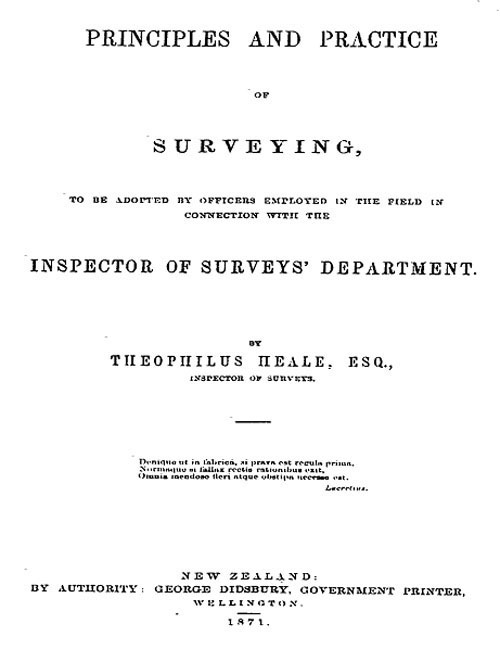
- By the 1870's, as before, Maori were lining up to sell land, this
time down the West Coast from the Hokianga to the Kaipara and government surveyors,
purchasing agents and Native Land Court judges had their hands full trying to
sort out the normally complex process of awarding legitimate owners with legal
titles to their blocks. Long-standing experience, hard-won over thirty years,
had taught the government that they must "dot all the i's and cross all
the t's" utterly, as any unadressed or overlooked issues would inevitably
come back to haunt them and cost them dearly. It was because of the unenviable
position that the government most-oft found itself in, having to repurchases the
same territory several times over, that the 1865 Native Land Court was established.
By the 1870's, the carefully monitored, step-by-step process, leading to a completed
sale and transfer of clear, undisputed title to the Crown, was subjected to stringent
"rules of engagement" covering every stage, resulting in no unresolved
issues, loose ends or any conceivable prospect of future problems and challenges.
- Strict
rules, applying to the transfer of land ownership from Maori to the Crown, had
first been instituted in 1840 with Lieutenant Governor William Hobson's requirements
of Article II of the Treaty of Waitangi. All land purchase titles or claims to
settler ownership, prior to 1840, became null & void in the estimation of
the Queen's government and subject to full review. The imposed restriction under
the treaty , which forbade direct sales from Maori to European settlers, was reinforced
by the Native Land Purchase Ordinance, 1846, which made it a criminal offence
for a European to purchase such land or to be found in occupation of it. By section
73 of the Constitution Act, in 1852, the same prohibition was repeated; so
also in section 75 of the Native Lands Act, 1865, section 87 of the
Native Land Act, 1873, and subsequently continued in section 117 of the
Native Land Court Act, 1894. From the outset of the colony, all land transfer
had to proceed stage-by-stage through a carefully regulated process, stringently
monitored and overseen by government officials. Some of the strictest practices
related to surveying and the Survey's Department adhered to a step-by-step system.
A raw proposal moved from being a rudimentary idea, through several stages of
surveying refinements and official approval, to become a fully signed off, described
and approved, precisely drawn and officially registered block plan.
- In
conjunction with the array of Acts devoted to establishing Native Customary
Title and the careful processes of transforming them into Freehold Title,
were additional built-in protections. In 1870 the first Native Lands Frauds
Prevention Act was passed. This invalidated all alienation of Native land
if (a) contrary to equity and good conscience; or (b) made in consideration
of the supply of liquor, arms, or ammunition; or (c) such that sufficient
land was not left for the support of the Native. Trust Commissioners were appointed,
and no instrument of alienation was to be valid unless endorsed by a Commissioner
with a certificate that the alienation was in accordance with this Act. This was
in full compliance with Lord Normanby's brief or instructions to Captain
William Hobson in 1839. By the Native Land Act, 1873, Native reserves were
to be set apart and to be inalienable, without the consent of the Governor.
In this incentive, every precaution was taken to protect Maori in compliance
with Lord Normanby's 1839 instructions, wherein he wrote:
Nor is
that all: they [the Maori people] must not be permitted to enter into any
contracts in which they might be ignorant and unintentional authors of injuries
to themselves. You will not, for example, purchase from them any territory the
retention of which by them would be essential or highly conducive to their own
comfort, safety, or subsistence. The acquisition of land by the Crown for the
future settlement of British subjects must be confined to such districts as the
natives can alienate without distress or serious inconvenience to themselves.
To secure the observance of this - will be one of the first duties of their Official
Protector.
Within the terms of the 1873 Native Land Act every
instrument of alienation had to be explained to the Native by an interpreter,
accompanied by a fully endorsed statement, describing its contents, in the Maori
language.
By 1840, when the British Government was established in New Zealand,
Te Roroa could make no claims to ownership of any territories based upon conquest,
as they had been driven off their former lands of inheritance and possession and
were now reduced to the lowly status of, what Ngapuhi elder Graham Rankin called,
"squatters living on the fringes of the Waipoua Forest". They
were also, disparagingly termed, "Ngapuhi's dogs", as they were
living on the lands of Ngapuhi as tolerated pets.
Under the Maori system,
they were a fully dispossessed people without mana, considered as "squatters".
Through marriage into the owner tribes, they could gain access to an inheritance
for their children, as Tiopira Kinaki did in marrying a woman of Ngaitu.
When
the sale of large blocks down the West Coast to the Crown was instigated by Maori
vendors, however, Te Roroa's very avaricious leader, Tiopira Kinaki, was quick
to put his own name forward as a claimant for anything and everything he could
grab, whether based upon pre-Treaty or post-Treaty, long-term or short-term"squatting"
on the many lands of exile to which Te Roroa had been chased, shunted and hunted.
What Te Roroa had not been able to hold onto or gain through fighting prowess,
they would attempt to acquire through the Colonial Government's Native Land Courts
and the British legal system, simply on the basis of having "been there".
More than any other hapu, the long-term Te Roroa fugitives and refugees had been
chased everywhere up and down the West Coast, fleeing to survive, and would now
try to cash in on their long string of defeats, by claiming all of the refuges
and sanctuaries where they had holed-up. By the 1880's, Tiopira and his followers
had managed to acquire clear title on about 200,000 acres of land in multiple
bogus claims. These illegitimately awarded titles he mostly sold to the Crown,
but retained large reserves for himself at both the Waipoua and Waimamaku Blocks.
Clearly, the biggest losers on the ground in the North became the biggest winners
in the Native Land Courts. Tiopira's "squeaky wheel getting the oil"
antics and that of others like him, caused an outcry from legitimate owners, who
forwarded petitions for redress to Parliament.
Tiopira Kinaki sometimes
initiated private surveys of land he didn't own. The record shows that he made
a profession out of, deceitfully, trying to sell the lands of other tribes "out
from under them" or "unbeknown to them" or tried to get his name
on parts of any and every block in the region, stretching from Hokianga to the
Kaipara. With British law having now replaced the former Maori conquest system,
the very shrewd and money-grubbing Tiopira Kinaki found he could make overtures
to the more accommodating and compliant, "third party", Colonial Government
for the acquisition of rights that he did not have under the Maori system of winners
and losers.
By the time of the signing of Treaty of Waitangi in 1840, he
and his tribe were mere tenants on the lands of others and the recipients of their
charity or toleration. By the mid 1870's, however, when land block sales down
the West Coast above Dargaville were well underway, the old warrior structures
were all but gone and Tiopira could appeal for full titles or part-ownership based
solely upon "occupation" without fear of reprisal from his hapu's
conquerors, who were the true owners. A lot of water had gone under the bridge
and his world was a very different place to that of his grandfathers.
Tiopira
Kinaki was very adept at working the "all-too-accomodating" British
legal system, which was duty-bound to honour Lord Normanby's brief to Hobson for
the protection of all Maoris. Since 1840 many "would-be" humane Acts,
protective policies & measures had emanated from Normanby's original foundation
instructions. By the 1880's, however, this "all-too-accomodating" approach
by the colonial government brought the Native Land Courts into derision and heavy
criticism from Ngapuhi and others, for awarding titles to illegitimate claimants
like Te Roroa.
Ngapuhi well knew their lands of possession, which they
clearly described in song or chants and had gained by "occupation, ancestry
and conquest". These three foundation factors were supposed to be the
determining criteria upon which the various Land Courts made ownership decisions,
when awarding Maori titles from 1840 onwards. What had happened prior to 1840
was none of the colonial government's business or concern and they merely exercised
their mandate to govern based upon existing circumstances from February 6th 1840
onwards, after Ngapuhi held lands were ceded in sovereignty to Queen Victoria.
Of
these combined, defining and foundation criteria of "occupation, ancestry
and conquest". Te Roroa could never adequately satisfy more than one
condition in the forty-five years before 1840, which was their spasmodic and temporary
"occupation" of lands owned by others. After their return from
exile in 1825, this "occupation" was predominantly within the
territories fully owned by Ngapuhi chief, Parore Te Awha. With the departure of
Te Kaha and Te Kairau from Maunganui Bluff around 1825, Ngapuhi chief Matui Parore
took full control of lands from the Waipoua Forest to Te Papa at Kaipara and Te
Roroa hapu, once permitted to come out of exile by chief Hongi Hika, became "squatters"
on Parore's lands (See: The Kaipara Minute Book No. 3). The historical
record is very clear on this point.
Between 1880 and 1890, alone, Maoris
presented over a thousand petitions to Parliament (AJHR 1891, G1 pg.
xi.) without avail, to sort out fraudulent use of the Native Land Courts to
perpetuate the awarding of bogus titles to people like Tiopira Kinaki. An 1888
newspaper account states:
LANDS BILL SCORNED BY MAORIS
Kihikihi
Saturday
Mr. Ballance's Land Bill of this session, so
far as its provisions are known, is not more acceptable to the natives as that
of last year. It is the working of the Native Lands Courts that they are disgusted
with, such cases as those at which Sir Robert Stout's Bill points at and others
where the real owners have been deprived of their land altogether.
Another great cause of discontent is the case with which bogus
claims are admitted; and that in some cases where the claims are admitted,
and that in some cases where the names of certain natives have been rejected by
the court, the names of those natives have been put into the certificates afterwards.
It is the administration of these Courts that they object to as altogether unsatisfactory,
but on Mr. Ballance's Native Committees the look with even greater distrust. They
would far sooner trust the judgement of a European than a Maori tribunal. In no
case can it be said that Mr. Ballance has met their wants or removed the objections
of the natives which stand in the way of a settlement to the land question satisfactory
to both races - June 7 1888.
Just
some of the block sales down the north-western coast, several of which Tiopira
Kinaki managed to get full or partial ownership of. In the end he accrued over
200,000 acres for himself and his hapu. He was awarded parts of several
more huge blocks, to which Te Roroa had fled to escape Ngapuhi, not shown. The
biggest losers in the northern wars became the biggest winners in the Native Land
Court.
The leniency or duplicity of Native Land Courts provided Tiopira
Kinaki with a means to get his finger in the pie for several of the following
blocks and others:
- 1870... Wairau Block... plan 2012... comprising
1129 acres for the Southern Wairau and 1410 acres for the North... total area
2539 acres...dealt with on the 10th of October 1870.
- 1870...Waiwhatawhata
Block... plan 2013... comprising 2114 acres...dealt with on October 10th (?) 1870.
- 1870...
Waimamaku Block.. plan 2014... comprising 2650 acres...dealt with 10th of October
1870.
- 1871... Kaihu Block ... plan 1946... comprising... 41075 acres...dealt
with 1871.
- 1874... Waoku Block No. 1. ...plan 3092...comprising 17650
acres...dealt with on the 28th of April 1875 based upon a plan by R.T. Davis from
1874.
- 1874... Opanake Block ... plan 3046A...comprising 14457 acres...dealt
with on 9th of December 1873... approved by Heale ...dealt with by Judge Rogan,
4th of June 1874.
- 1875... Waoku No 2...plan 3248... comprising 8017 acres
... dealt with on the 28th of April 1875... awarded to Heta Te Haara and Wiremu
Pou.
- 1875...Waimamaku Block... plan 3278A... comprising 27200 acres...
compiled in the survey office ... last plan done by Mr. Kensington on the 21st
of February 1875.
- 1875... Omu Block... plan 3202... comprising 3147 acres
and lying on the Northern Wairoa River between Ounwhao and Waiaruhe Blocks...
dealt with on the 27th of March 1875.
- 1875... Waipoua Block Plan 3277A
comprising (originally) 12153 acres for Waipoua No. 2 but later amended to be
12220 acres... and Waipoua No. 1.. plan 3277.... comprising 41181 acres but amended
to be 35300 acres with the removal of Wi Pou's land from the plan. An earlier
plan was 3232 for Waipoua 1...dealt with on the 15th of May 1875. Awarded to Tiopira
Kinaki and Hapakuku Moetara who also inherited all of Waipoua 2 as a reserve.
- 1875...
Waimata Block ... plan 3199... comprising 5699 acres... dealt with on the 19th
of May 1875 ...claimants were Parore Te Awha from the Te Kuhi hapu of Ngapuhi
and his servant lady, Ani Patene of the Te Taou hapu of Ngati Whatua.
- 1875...
Karara Block... plan 30671... comprising 30671 when first surveyed but later amended
to be 27700 acres... dealt with on the 22nd of May 1875. The sole claimant (representing
many) was Kamariera Te Wharepapa. The plan was certified by Barnard on the 8th
of May 1875.
- 1875... Punakitere Block... plan 3270... comprising 7959
acres... dealt with on the 12th of June 1875. Awarded to Western Ngapuhi.
- 1875...
Ounwhao Block... plan 3200... comprising 8190 acres... dealt with before the court
on the 27th of May 1875.
- 1875... Opouteke Block... plan 3214... comprising
43622 acres... but amended to 42000 acres when a reserve was cut out. Approved
subject to corrections on the 13th of May 1975, but was dealt with in the court
on May 22nd 1875.
- 1875... Pakanae Block 1... plan 3267... comprising 3189
acres and Pakanae Block 2... comprising 8955 acres ... dealt with on the 18th
of June 1875. Both of these join to the Waimamaku block and were awarded to Ngapuhi.
- 1875...
Waimamaku Block... plan 3278 before 3278A...claimants were Tiopira Kinaki, Hapakuku
Moetara and Te Rore Taoho. The map plan was based upon the survey of H&D Wilson,
drawn up on July 14th 1875 and comprising 24500 acres... minus Wairau native reserve.
The government had purchased 27200 acres... dealt with on the 21st of December
1875.
- 1876... Kaihu No. 2 Block... plan 3509... comprising 11666 acres...dealt
with on the 14th of August 1876.
- 1879... Aoroa Block...plan 3756... comprising
13850 acres...dealt with on the 8th of May 1879.
SO
WHAT REALLY HAPPENED AT WAIPOUA AND MAUNGANUI BLOCK SALES?
The
circumstances of what transpired in the cases of the Waipoua and Maunganui Blocks
are very well documented and should be beyond dispute. Because of Tiopira's usual
tactics of attempting to raise the ante so that he could "milk" the
block sales, he caused disputes that had to be settled in the Land Courts or by
comprehensive Parliamentary enquiry. This led to large files of testimony from
the purchasing agents and others involved, which have survived intact since their
creation in 1876. The documents could not be more clear in the account that they
give. Each of the following statements can be fully substantiated by comprehensive
documentation on file in our archives:
- !n the 1870's, Chief Parore
Te Awha was living on his estate at Kaihu Valley (Dargaville). He was, by now,
an elderly man and very well known as the chief of the district. Tiopira Kinaki,
who was relatively unknown, had been in residence at Parore Te Awha's Waipoua
Forest settlement with his hapu since about 1856 and were the remnants of Te Roroa
people allowed, by Hongi Hika, to come out of exile and live as squatters on Parore's
land.
- At the beginning of October 1874, word came to Chief
Parore Te Awha, that Tiopira Kinaki of Te Roroa, along with traditional allies,
Ngatiwhatua and Uriohau, had deceitfully taken large deposits from purchasing
agents for the sale of Parore Te Awha's land extending from the Waipoua Forest
to south of Maunganui Bluff. Also Wi Pou who held a legitimate claim to lands
to the eastern side of the Waipoua Forest and who had become allied with Tiopira
Kinaki, engaged the government surveyors, Barnard and Stephens to do a "private
survey" of the areas just south of the Bluff on Parore's land. The location
in question was where Ngapuhi chiefs Te Kaha and Te Kairua had maintained their forward base camps
during the era of the Musket Wars until 1825. Once Hongi Hika had decimated Ngati
Whatua and reduced their numbers down to a little over 200 survivors in the battle
of Ikaaranganui of 1825,
these Ngapuhi chiefs had moved back to Kaikohe. Parore reassumed full control
of the whole region thereafter. Fifty years later, in 1875, Wi Pou's hapu, composed
of about forty individuals, wished to create for themselves two reserves there
on the south side of the bluff, between the sea and a small lake, and would call
the reserves Manuwhetai and Whangai-ariki. Parore Te Awha was enraged by this
attempted theft and complained to the government that 'Tiopira
Kinaki has sold his [Parore's]
land called Maunganui to the Govt in a clandestine manner'. (See Record
74/5815, Parore's letter to Brissenden, sent on October 6th 1874 and received
on October 27th 1874).
- There can be no dispute regarding
Te Awha's long-term possession of this land, based upon "occupation, ancestry
and conquest". This renewed attempt by Te Roroa to claim the traditional
land of Ngapuhi, was merely a duplication of Taoho's failed 1805 attempt to steal
the same territory from Parore Te Awha's father, who subsequently cut down Taoho's
rahui or boundary marker and told him, under no uncertain terms, that Te Roroa
hapu had no possession of land there. Shortly after that 1805 incident, Te Roroa
were vanquished from the entire region and found themselves in full retreat from
the warriors of Pokaia. Thereafter they were forced to endure the indignity of
almost twenty years in ever-present dangerous exile near Tokatoka and the Kaipara
Harbour.
- J.W. Preece said in his 12th February 1876 report to
the Under Secretary, Native Office: 'It will be remembered that with regard
to the first two blocks, namely Waipoua and Maunganui, a very sore dispute has
existed for some time between the old chief Parore Te Awha, supported by Te Tirarau
and the Ngapuhi on the one part and Tiopira Kinaki (a man comparatively unknown
outside his own tribe, the Roroa) supported by Ngatiwhatua and Uriohau tribes
on the other part.' Preece went on to state: The Agents...having
entirely ignored the rights of Parore and his people, caused so strong
an opposition on his part to the survey and sale of the land that at one time
there seemed to be every probability of hostilities between the tribes breaking
out'.
- At this time, some government surveyors were engaged
in ground survey of the coastline tracts above Dargaville, extending to the Hokianga
Harbour and overland eastward the Tutamoe Range. Surveyors, Barnard and Stephens
were working at Tutamoe and the Wilson brothers were doing a ground survey down
the coast. All were working in with local natives, who were telling them where
the tribal boundaries lay. At the same time, Percy Smith and others were doing
the much larger triangulation survey, which was tied to the Auckland trig at Mt.
Eden. Eventually, the ground survey plans for the individual blocks could be tied
to the much larger triangulation survey and refined for accuracy.
- There
was nothing to stop the natives from hiring surveyors to do private work for them,
in anticipation of making application for title of a reserve within a larger block
plan. The Tiopira Kinaki and Wi Pou confederation engaged Barnard and Stephens,
in a private capacity, to do a rough compass survey of the two reserves and establish
approximate boundaries. This preliminary compass plan could serve as the beginning
point of a proposal, which, when put through several further stages of both surveying
and Land Court scrutiny, might result in a title being awarded.
- In
accordance with the 1873 Act, which complied with Theophillus Heale's, Principles
And Practices Of Surveying To Be Adopted By Officials Employed In The Field In
Connection With The Inspector Of Surveys' Department, dating to 1871,
it is impossible for the Manuwhetai and Whangai-arki reserve proposals to have
achieved any official status. Block survey's proceeded in stages of official recognition,
according to stringent rules that the government surveying teams were obliged
to comply with. Government surveyors, working to the published rules outlined
in the 1871 publication, undertook the large area triangulation and geodesic survey
for the Waipoua/ Maunganui blocks just prior to 1876. At the termination of the
official survey and the completion of a formal deed of sale arrangement, title
was passed from the Maori vendors to the Crown. Under the strict criteria in place,
it was impossible for the former Manuwhetai and Whangaiarki reserve proposals,
based upon a rough compass survey, to advance any further, other than to be received
and acknowledged provisionally. A Crown grant, unless acted on via a full and
proper application for title to the Native Land Court, could never advance any
further. No such application was ever officially lodged, nor was there any proper
geodetic survey completed to legitimise such a grant.
Some extracts from
Principles and Practice of Surveying
(Page 7 & 8) 'It
necessarily involves the absolute abandonment of all compass
bearings, and of all unconnected surveys. Since surveys of any considerable
extent must approach two or more trig stations, nothing
is easier, when it is desired to check such section survey, than to ascertain
independently the true relative position of two or more points at the opposite
sides of it, and from their discrepancy with the triangulation, any errors of
measurement or angularity can be determined; and the work can then, after rectification
if necessary, be laid down on the general maps constructed from the triangulation,
with a certainty of its truth, within a limit of error quite inappreciable on
maps of ordinary scale.
Theophilus Heale goes on to state:
Since the subdivision of land without previous triangulation,
and by compass bearings, is so rude and uncertain a process that it can hardly
properly be called surveying, as it will certainly
not fall under the definition here given; and since, when the whole area
has to be divided into small sections, this miserable makeshift
actually involves a far larger expenditure of time and money than to triangulate
and survey the land properly, no rules or instructions are laid down for its performance,
which I would altogether deprecate and oppose. And if, from circumstances arising
out of the operation of the Native Lands Act, it should still occasionally be
necessary to admit such unconnected sketches for
the purpose of the investigation of titles, they ought to
be received only provisionally, and to be subject to revision whenever the major
survey is advanced to embrace them, and then only, to be available as the foundation
for Crown Grants'. [Emphasis added to show the true status of the
Manawheti and Whangai-ariki "reserves proposal"
and how it did not meet or achieve even minimum surveying requirements of the
government].
For a survey of this type to achieve any further official
status, it would have had to be conducted under a formal pre-arrangement, via
application and government instructions using the services of government employed
surveyors assigned the task. The surveyors in question would have had to use an
optical theodolite of sufficient size (ten inches) and the completed
survey based on proper geodetic methods, in accordance with the rules,
using set trigs and triangulations
to accurately determine azimuth angles, exact positions and size of allotments.
However, because no binding, prearranged agreement was ever formally entered into
between the government and the Maori owners for a Crown grant, the earlier proposal
became null and void.
The
dignified old Ngapuhi chief, Parore Te Awha, was enraged by this attempted theft
of his land and required that all surveyors, government or private, get out immediately.
He said to the government 'that the survey should not be
carried through, if the surveyors were to persist that they would be sent back
by guns'.
On
the 21st of February 1875, Parore wrote to Sir Donald McLean stating:
Friend
greeting,
I have a word to you about
Maunganui and Waipoua and up to the top is mine and
it has been surveyed and I then went direct to Maunganui and I then wrote direct
to the surveyor and stated that the survey should stop at Waikara [2.7 miles
or 4.3 kilometres north of Maunganui Bluff summit].
Hone Mohi Tawhi took
my letter to the Surveyor Mr Wilson [A government surveyor being guided through
the district by Tiopira Kinaki]. The Pakehas would not listen to stop at Waikara.
I then returned to the Wairoa and Mr Preece said to me the word to me was that
I was to desist from going to Maunganui. I then said I will not desist from going,
for if I do, but if it (the survey) stops at Waikara, I will not go back.
Then
Mr Preece said to me if Waikara is left behind it will be wrong. It was then I
said my slow word (I reluctantly said) let the matter be settled in the manner
of our ancestors and fathers. Then Mr Graham said let it be left for the law to
look into[W.A. Graham was Parore's Surveyor] - Enough I will return
there only once more and that will be the end.
That is why I write to you.
My land has all been surveyed. My word was that the land be divided at Waikara.
Enough the matter rests with the administration of the law when an application
is made for Maunganui, Waikara, Te Paku, Paketotara, Waima, Mangatu, Waitomi,
Te Waokupu to the line of Pira, thence to the line of the timber (land) sold to
Mr Monk - thence to the peg of Mr Monk's line at Ritoatehe, the line of Mr Monk's
timber Paketi Te Kawa kapake te peke o te Reti to the peg of the land leased
for flax, thence to te takahanga. [Parore here gives the boundaries of what
was to become the Maunganui block].
These are the names of my pieces which
are all taken by the Roroa one is Te Uruti [South of the Bluff below
the Waihoupai Stream] Te Kapoai is another, Te Waipohuta kawa is another, Waihopai
[River to the South of Maunganui Bluff where the entrance met the sea on the
edge of Manuwhetai], Te Patapata [Western wall of Maunganui Bluff].
Enough this is the end of the names of my pieces. [referring to the coastal
boundary of what became the Maunganui Block where Manuwhetai and Whangaiariki
lay] If the law is strong enough to divide them it is well.
Friend Sir
Donald McLean my heart is crying towards the law namely towards you. If my land
is divided by the law it will be right. If it is not divided I
shall be forced into the ways of the ancestor and fathers. If my letter
reaches you reply to it. Enough I have finished, from your true friend Parore
te Awha. (Wai Doc Bank: 000389A-000391).
The
terrain at the base of Maunganui Bluff's southern side, bordering the sea, being
the location of present day Aranga township, was where Wi Pou, Tiopira Kinaki
and others of the confederation envisioned having their Manuwhetai reserve, if
they could wrestle the location out of the ownership of chief Parore Te Awha.
Dispossessed
farmer and victim of a false, modern-day land claim, Allan Titford, points to
the map location of Wi Pou's proposed Whangai-ariki reserve, just south of Maunganui
Bluff. In the immediate background is the remains of the PA of chiefs Te Kaha
and Te Kairua. It acted as a forward position for Ngapuhi to protect their lands
from their enemies, Te Roroa and their Uriohau and Ngati Whatua allies, from 1806
to 1825. After that time, Hongi Hika totally decimated Ngati Whatua. A year before
that Te Roroa, under Taoho, foresaw their impending doom and abandoned the fight.
Taoho, with the assistance of Te Kaha and Te Kairua, pleaded with Hongi for the
right to come out of exile and live in safety in Ngapuhi territory under Parore's
protection. This was granted and the defeated Te Roroa exiles were given sanctuary
as squatters.
- In Parore's opening remarks
within his letter, he mentions Maunganui and Waipoua then states: and
up to the top is mine and it has been surveyed. In this instance he
is obviously referring to the fact that Waipoua block
belongs to him. He's also referring to the fact that the government's
ground survey of Parore's Waipoua block has proceeded down the coast from the
north and is nearing Maunganui Bluff, which area has
not been surveyed yet. Having found out that others are claiming all
manner of pieces and parcels of his traditional lands from the top of Waipoua
block to south of Maunganui Bluff, Parore Te Awha frantically wants all surveying
to stop. In a much later statement by Henry Tacy Kemp, given while reviewing events
after the Waipoua and Maunganui Block sales to the Crown were completed, Kemp
states: 'and it was with some difficulty that we could
persuade Parore to agree to this, when it is borne in mind that Waipoua itself
was, for very many years, the favourite residence of Parore...' His
tenure on this Waipoua-to-Maunganui-to-Kaihu land, or that of his parents and
grandparents before him, could not be disputed. As for Tiopira Kinaki and his
Te Roroa hapu, however, they'd been living at the Waipoua settlement for about
18-years when they laid claim to it, took deposits for it from purchasing Agents
and tried to sell it "clandestinely" out from under Parore Te
Awha, paramount chief of the district.
- Preece
stated: I was at this time working as a private Agent, and advised Parore to
permit the survey to continue, and trust his claim to title to the Native Lands
Court, where he would be sure to secure his rights, whether
the land was surveyed by the other claimants or not; to which he, after
considerable hesitation, consented, and has since then patiently awaited the result
of the decision of the Court: at the same time he has refrained from taking any
deposit, or committing himself in any way as to the sale of the land. Here
Preece is differentiating between the large scale ground survey of entire blocks,
being conducted by the Wilson brothers, in behalf of the government, but makes
reference to the private surveys of Barnard
and Stephens to mark out reserves for Wi Pou and others within Tiopira's confederation,
which they intended to "buy back" after the large blocks were sold to
the Crown. At this juncture, there is no indication that Parore Te Awha was prepared
to sell any of his land at Maunganui Bluff, extending from the Waikara Stream,
2.7-miles north of the Bluff, going southward to the Kaiiwi Lakes.
- J.W.
Preece also wrote: At the time Parore, on my advice,
desisted from taking active measures to forcibly stop the survey, and consented
himself by asking the government to stop it, instructions to which effect were
given to the Hon. the Native Minister, which however, did
not reach the surveyors until the work was done. In
this, Preece is giving an account of how the government's ground survey down the
coast, to create a combined block plan incorporating the entire Waipoua and Maunganui
areas of the coast, was substantiality completed by the Wilson brothers before
the Native Minister had time to instruct them to stop. Other correspondence, however,
shows that they were unable to fully complete the work and had stopped at the
Waikara Stream, as required by Parore Te Awha.
- On
the 4th of March 1875, the Inspector of Surveys, Theophilus Heale wrote: I
have the honour to inform you that during the survey of the large Waipoua Block
lying between Hokianga and the Kaihu Block, a serious dispute arose as to boundaries,
between Tiopira & party on the one side and Parore (Ngapuhi) of Kaihu and
on the other. The disputed position lies at Maunganui Bluff. Finding that this
dispute was likely to lead to a breach of the peace between the two parties, I
requested the Messrs. Wilson to discontinue the survey which
has been done.
The question now rises as to whether
the Block cannot be adjudicated upon in the present state of the survey.
The
whole of the boundaries are surveyed with the exception
of that portion of the coast lying between the north boundary of Kaihu Block and
a little stream immediately to the north of the Bluff. The extremities
of Messrs. Wilson survey are (or will be) corrected with the Triangulation and
it is quite possible to sketch in the intermediate coast
line from the Trig Stns as with the exception of the Bluff itself the coast
is a perfectly straight line...
As it is important to get the question of the
title to Maunganui settled, seeing that it has been in dispute between these two
hapus for many years past and is a matter that is always later to crop up again.
I submit that such a sketch survey, should be accepted and
if not declared sufficiently accurate for further purposes, that the remaining
piece of coast line should be surveyed when the title has
been definitely settled. Then the purpose of enabling Messrs. Wilson to
complete their map. It becomes more than ever necessary that a preliminary
calculation of the Triangles should be made at once. Heale is here stating
that the survey is incomplete from the Waikara Stream, southward to the Kaihu
Block and that only preliminary sketch plans, of insufficient accuracy, can be
created concerning Parore Te Awha's land. No more surveying could be done until
ownership of Maunganui Bluff, and land lying to its immediate south, was decided
by the Land Court and amongst contending parties.
- Heale's
comments were reiterated by Sir Donald McLean on the 18th of March 1875 in his
letter to Mr Brissenden: Sir, I have the honour to inform you that the Government
have received a letter from Parore, complaining of the survey of the Maunganui
block. The Government do not wish the survey of any land
to be proceeded with in the face of such opposition as there appears to be in
this case. You will, therefore, on receipt of this letter, without delay
instruct the surveyors to withdraw from the block,
and will, until the dispute is satisfactory settled among the Natives, suspend
the negotiations for the purchase of the same.
- This
and other correspondence tells us very clearly that, once Parore Te Awha complained
and threatened to "return to the old ways" to stop this attempt
by the Tiopira Kinaki led confederation to steal his land, the government also
stopped all of its surveying and purchase negotiations with any and all parties.
Some private purchasing agents, in their ignorance of regional history, had been
conned into believing that Tiopira Kinaki owned tracts that, in fact, weren't
his. They had stupidly and prematurely advanced substantial deposits to the "squatter-guest"
for the purchase of those lands but now, for the first time, were coming face
to face with the dismal reality that neither Tiopira nor his confederation of
allies, necessarily owned those lands. Everything went into an immediate state
of abeyance and the government backed right off, pending decisions arrived at
by the Land Court. Any earlier private surveys undertaken and paid for by Tiopira,
Wi Pou or others, for the cutting out of proposed reserves to the south side of
Maunganui Bluff, would become null and void and meaningless if the Maunganui Block
was awarded to Parore Te Awha. The proposed reserves of Manuwheti and Whangai-ariki
were never initiated by Parore, but by individuals he perceived as enemies, who
were trying to steal his land. The proposed reserves and general encroachments
into Parore's land had been a very grave insult to him, especially after years
of harbouring and protecting the Te Roroa fugitives, who had now proven to be
treacherous ingrates. If the Land Court decision went in Parore's favour, the
earlier proposals for "reserves" south of the Bluff would become utterly
meaningless. Parore would then have the opportunity to nominate any terms and
conditions he liked in his dealings with the Crown, including choosing a plot
within his holdings for a reserve location of his own choice. The rest of his
block could be sold to the Crown, if that's what Parore decided he wanted to do.
- From
October 1874 and May 1875, the bitterness between contending parties continued.
In about January 1875 Tiopira Kinaki intimated that Parore Te Awha was going
to lie in wait and shoot him. Several attempts were undertaken to hold Land
Court hearings leading up until May and the hearing concerning the Waipoua and
Maunganui blocks was finally scheduled for May 19th. J.W. Preece gives an account
of the fiasco that ensued, with Tiopira's heavy handed tactics of arriving at
Court with a drunken, armed mob, as well as other problems that led to the hearing
being forcibly cancelled:
Preece wrote: 'In the first place the
weather was so extremely bad that it was impossible to get an open air meeting
to enable them to discuss the matter thoroughly.
Secondly, Parore was and
still is so very unwell and utterly unable to advocate his own case, yet at the
same time was very determined not to be talked down by the opposite party. Tiopira
offered what I think very fair terms to Parore and I strongly advised him to accept
them, but the old man was on his dignity. He stated that they had sold the land
without consulting him, that they had taken five hundred pounds deposit on it
which they had denied when he first charged them with it, that they had afterwards
persisted with the survey of it in spite of his protestations and to finish all
they had come to Court the greater number of them armed
with guns.
Knowing there was a great deal of truth in what he said,
and considering the state of his health I did not press him to come to terms with
them, particularly as the plan before the Court only contained about half of the
estate in dispute, the other half being surveyed off and advertised to be heard
at Hokianga under the name Waipoua, this I did not know until I arrived here as
the plan was only sent in by the Surveyor at the last moment.
With regard to
the Uriohau and Ngatiwhatua bringing guns I felt
that, although I do not for a moment suppose that they could have attempted to
use them, yet it was sufficient cause even if Parore had been well to have the
case adjourned. Preece mentions that the armed mob were assembled 'a few
hundred yards down the river' and that 'they were
drinking there to a large extent'.
J.W. Preece went on to state:
'Parore has written a letter to Judge Monro asking him to adjourn the Waipoua
Block being a part of the same tribal estate as Maunganui and to have the two
cases heard together here next summer. I shall support his application for an
adjournment for I feel complications will arise unless the two blocks are heard
at the same time, and it is impossible for Parore and Tirarau [Paramount chief
of Ngapuhi] to attend the Hokianga Court'.
- It was unknown to
the surveyors what outcome of the court case would be, but they dutifully assembled
whatever materials they had on hand in order to provide sketch maps or proposals
related to the lands in dispute. Everything was now at a stalemate, with no possibility
to complete either the ground survey or the larger triangulation survey over the
disputed territory until the outcome of the court case was known. The court was
not going to sit until the summer of 1876. A tracing of Barnard and Stephen's
rough compass plan, relating to Wi Pou's idea of establishing reserves called
Manuwhetai and Whangai-ariki, was forwarded in to the Surveying office as a proposal.
It was then copied into the records at the Auckland Office of the Inspector of
Surveys, Theophilus Heale.
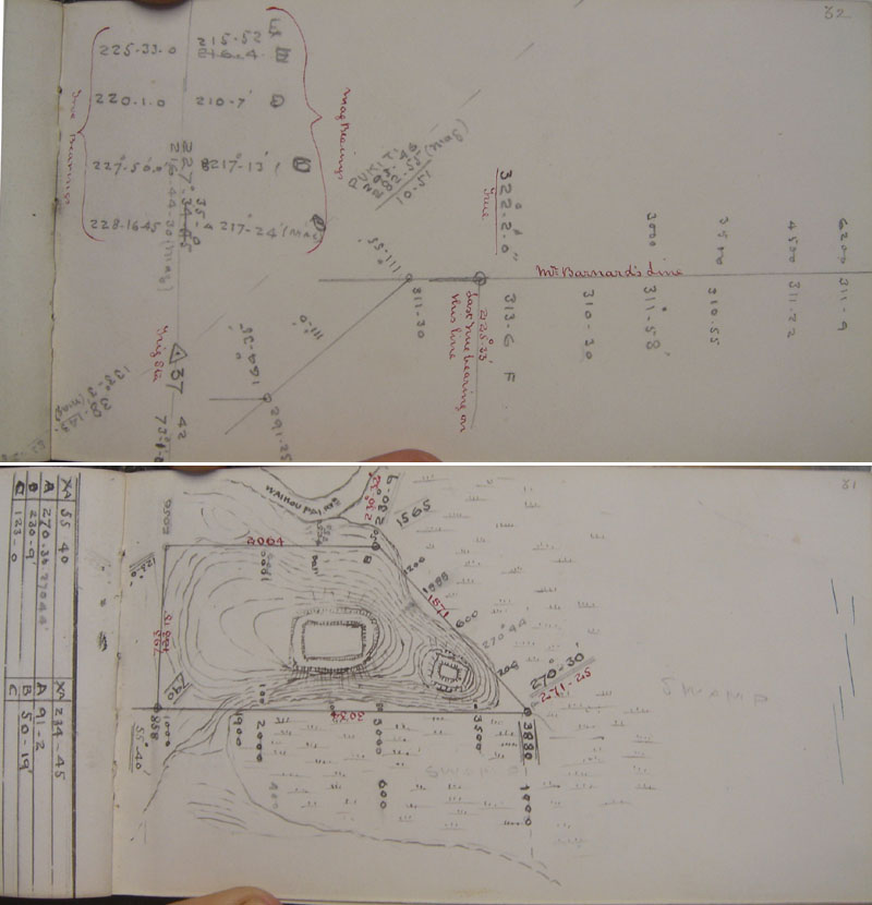
In
1874, Wi Pou of Ngaitu had paid private surveyors, Barnard and Stephens, to do
a compass plan of his proposed reserves to the southern side of Maunganui Bluff.
He wished to call these reserves Manuwhetai and Whangai-ariki. Whether or not
the reserves idea went ahead and moved, in official status, from a proposal to
an accurate theodolite survey tied to trigs, then onward to the further stage
of awarded title, would depend on the outcome of the Land Court hearing scheduled
for February 1876. Tracings of the sketch plans of Barnard and Stephens were sent
to the Surveying office by mid 1875 and, thereafter, were copied into Field Book
13 in pencil. Corrective notations were later added in red
pen, as best as could be done considering the scant and inaccurate information
available. One added red pen notation reads, Mr.
Barnard's line. Much of the recopied pencil sketching on both the Manuwhetai
and Whangai-ariki plans was later overdrawn in black ink for greater clarity.
In the field, the surveyors used only "lick"
pencils and never permanent ink that could not be erased for corrections and adjustments
to lines. Field Book 13 was a "bitsa" book, incorporating the work of
a variety of surveyors. It's assigned owner was Frank Stephenson Smith, who worked
in very closely with his older brother and senior surveyor, S. Percy Smith, doing
the major triangulation of the North Island. For over seventeen months, from October
1874 until February 1876, no government employed surveyors were permitted to set
foot upon the Maunganui Block. Some semblance of a plan for the two reserves had
to be completed from the submitted tracings, however, as they might be needed
in evidence when the Native Land Court sat to hear the case and the claims of
all parties.
In the interim period, while awaiting the Land Court sitting
to determine the legal owners of the Waipoua and Manganui Blocks, surveying staff,
not knowing what the court would require from disputants on both sides, drew up
a single large plan, showing as accurately as possible, Wi Pou's two proposed
reserves. His proposed Manuwheti reserve was designated No. 3297 and his
proposed Whangai-ariki reserve was designated No. 3298.
At this
stage, the plan was only a very rudimentary and inaccurate proposal,
based upon Wi Pou's earlier engagement of private surveyors to rough out his proposal.
Although
no government surveyors had been permitted to enter the areas shown, due to an
interdiction imposed by Parore Te Awha, surveying staff prepared some provisional
materials pending outcome of the court case, which was unknown at that time and
would remain so for a further 5-months. In the final analysis the case went against
Wi Pou and his entourage and their proposal for reserves to the south side of
Maunganui Bluff became null & void.
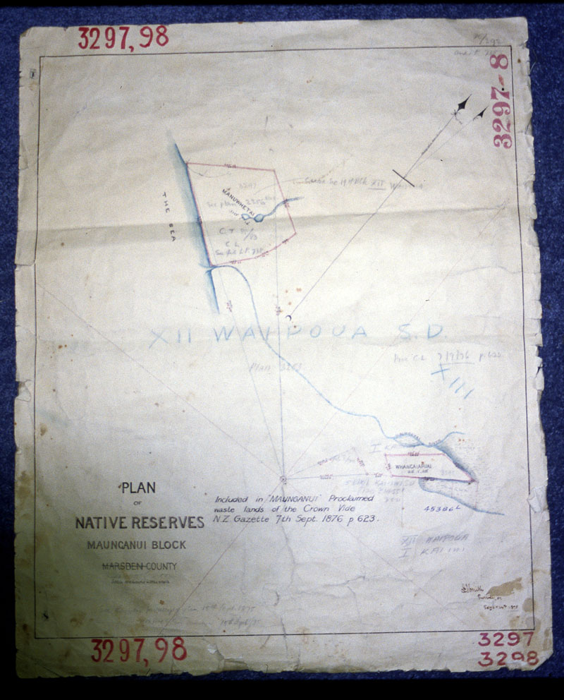
The
large provisional plan, drawn, on the 14th of September 1875, from Wi Pou's earlier
private survey sketch. From October 1874 until after the Land Court determined
that Parore Te Awha would retain full possession of the Maunganui Block, no surveying
by government surveyors was permitted within the boundaries of the Maunganui Block.
The Judge's decision to award the entirety of Maunganui Block to Parore was delivered
just before the 3rd of February 1876. By that time government surveyors had been
forbidden to work there for over a year and the above plan had to be created from
pre-1875 sketch plans forwarded by private surveyors. After the Crown purchased
the Maunganui Block from Parore, other notations were added to the above plan
and the Manuwhetai - Whangai-anriki reserves proposals became officially null
& void, as Parore Te Awha sold those areas outright to the Crown, which was
his unchallenged right at that juncture. In relation to the reserve proposals,
one official notation was added which said: Included in
Maunganui. Declared waste lands of the Crown. Vide NZ Gazette 7th September 1876
p 623.
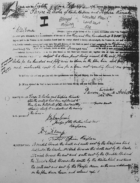
Here is the photocopy of the Deed that Allan Titford was able
to make in Tom Parore's office. The final title deed awards Maunganui Block
to Parore Te Awha, with Tiopira Kinaki's name also appearing on the Deed as
per a pre-arranged agreement. Parore Te Awha's name also appeared on Tiopira's
Waipoua Block Deed as per a pre-arranged agreement. All Maunganui Block ownership
was awarded to Parore and all Waipoua Block ownership was awarded to Tiopira.
Parore Te Awha had full and sole entitlement to sell or retain any and all of
the Maunganui Block after the Native Land Court's final decisions related to
the Maunganui and Waipoua Blocks.
The original of this deed was sent under orders of Sam Brown,
(Head of Lands and Survey and related to the Nathan cabal claimants) to Tom
Parore (Head of the Land Court, Whangarei and claimant). Although it and the
rest of the file had lasted for over a century when delivered to Tom Parore
and was seen in his office by Allan Titford who photocopied the above image,
it and the rest of the Maunganui file was "alleged missing"*
when it was required to be viewed by the Waitangi Tribunal. Because so many
of the "original documents" were missing and there was a dearth of
evidence, the benefit of the doubt went in favour of the Nathan cabal and the
Titfords were stripped of their farm and assets. In any and all earlier investigations,
it was decided that the Crown had no case to answer, as the complete dossier
of documents was intact and proved legitimate purchase from Parore Te Awha.
*Footnote: During
the period of Waitangi Tribunal hearings relative to this case, dispossessed
farmers Allan Titford and Don Harrison were in attendance at all known meetings
that they were informed about. These meetings, numbering about eight or nine
were mostly held at Kaihu or at the marae at Waipoua. There were a couple of
instances where they were barred from entry, as the meetings or parts thereof
were being conducted in secret, behind closed doors, with only the Maori contingent
allowed to be in attendance. Allan Titford, by a fluke of good fortune, had
managed to get a photocopy of the deed shown above and tried constantly to have
it accepted as evidence by the Waitangi Tribunal, to no avail. He tried to access
it through the "document bank" relative to the case, but could never
find it there. He repeatedly asked Sue Kendedine (Crown Law), David Colquoun
(Crown Historian) or other Crown representatives / historians like David Alexander
and Anderson Armstrong where the original "Deed"
was, but never got a straight answer and was simply "fobbed off" by
all of them. At all meetings where the dispossessed farmers were in attendance,
this foundation document was not seen or presented. Allan Titford gave a copy
of it to Sue Kendedine. We now know (2008) that David Colquoun had full, pristine
copies of all the original "Deed" documents all along and could not
help but know that there was absolutely no mention of any reserves called Manuwhetai
or Whangaiariki. The only legal reserve mentioned, after all parties had come
to mutual agreements, was Taharoa reserve for Parore Te Awha.
Further to
the foregoing, government correspondence (Dept. of Lands & Survey)
obtained under the "Official Information Act" shows that
Garry Hooker, Te Roroa's so-called historian, was
charged $11 under invoice C327815 for copies of these same "Deeds of Conveyance"
on the 7th of September 1981. The Te Roroa cabal obviously knew the "Deeds"and
accompanying testimonials written thereon were damning evidence against their
claim, so made them "disappear" and never feature in the Tribunal
hearings.
- On
the 17th of July 1939, an inquiry was held to ascertain why the two reserves,
were not cut out of the sale on or shortly after February 8th 1876, when Parore
Te Awha sold the whole Maunganui Block to the Crown. In preference to those pieces,
Parore designated a 250-acre reserve for himself that he wished to call Taharoa,
bordering on the southernmost of the three Kaiiwi Lakes.
Expert witness from
the Lands and Survey Department were brought in to give evidence at the 1939 enquiry.
Acting for the Crown was Mr. V.R. Meredith who, in conjunction with a Mr. Darby,
answered the questions of Judge Acheson.
- Acheson:: Mr. Darby,
how do you account for the fact that the plans of Whangai-ariki and Manuwhetai
were made?
- Mr. Darby: There would be a wish on the part
of some natives to have the plans made, and they would ask a surveyor to have
it done. I can find no record of any request or authority to do it, in fact authority
was not necessary to do it in those days.
- Acheson: Some
natives would ask for a plan and the private surveyor would make it?
- Darby:
Yes. As the Inspector of Surveys states, any native could
ask a surveyor to make a survey and send in a plan.
This line
of questioning continues and Mr. Meredith substantiates the testimony of Mr. Darby.
- Meredith:
There was an original plan dated 17th May 1875 of the whole block, and then there
was a sale on the 8th February 1876, but between those two dates there was another
plan made of these two reserves, on the 14th September 1875.
- Acheson:
From your knowledge of the position why should that intermediate plan have been
made between the time the original plan was made and the date of the sale?
- Meredith:
Anyone could instruct a surveyor to make a plan. There is
no record that it was sent to the Native Land Court or was required for the Native
Land Court.
Judge Acheson then probes the reasons why no further
action was ever taken with regards to these reserve proposals.
- Acheson:
When you get a plan showing a reserve that is not shown as a reserve in your deed
of sale, do you just allow it to be there and not mark it as being repudiated?
- Meredith:
The Register shows a plan of that number as being received, but there is no action
whatever taken with it. It was simply left to lie there. I presume no further
action would be taken after that note was put on it stating the
area had been proclaimed Crown Land.
The long report goes
on in much the same vein. This was not an actual court case as such, only an inquiry
to see if one was justified. The Nathan cabal really try to make it sound like
this was a court case and get as much mileage as possible out of Judge Acheson's
overly accommodating attitude*. When the modern-day claimants made their "representation"
of this inquiry before the Waitangi Tribunal, they are reported to have used their
own "doctored", typed version ("for easier reading"), which
omitted significant detail not helpful to their case. In the final analysis, however,
Chief Judge Shepherd, who Acheson was subordinate to and was required to report
to, found no evidence whatsoever that there was any substance to the 1939 claim.
With full access to all of the surveyor's, Native Land Court and Parliamentary
reports and letters or gazette notices, etc., it was clearly evident that everything
had been settled correctly in 1876, with no oversights, loose ends or outstanding
issues. It is also significant that neither Parore Te Awha nor Tiopira Kinaki
ever mentioned these reserves during the remainder of their lives or in their
wills as items or parcels of land the Crown forgot to give them. Tiopira had no
claim on anything to the south of the Bluff and every square inch of that region
became the total and undisputed title of Parore Te Awha.
Merridith said
the following in 1939:
That is the point I am making. They [Manuwhetai
and Whangaiarikiki] were not for Parore, because Graham [William A.] was
Parore's surveyor and he made the 250 acre reserve [Taharoa Reserve], and
in that respect it is clear that the data incorporating that 250 acre reserve
on the plan of transfer would obviously be in existence prior to the formal plan
of the reserve, which was signed, I think, one month later by Graham.
I
think there is a month or six weeks between the date of the transfer and the date
of that 250 acres plan signed by Graham and put in by him. What I am leading up
to is this: you will notice in the statement of Preece's on behalf of the Crown
both Tiopira's and Parore's reserves are taken into account, and the purchase
for that is deducted from the total purchase price.
Note:
Tiopira was awarded a very large reserve at Waipoua and Parore was awarded a 250
acre reserve at Kaiiwi Lakes, which they bought back off the Crown after
selling the rest of their holdings.
They are taken into
account so that if there were any further reserves to be taken out which are not
mentioned there should be a deduction in price similarly to the two cases of the
reserves which are known and the purchase price for which is deducted.
Note:
It must be remembered that full title for the lands or blocks in question was
first awarded to the Maori owners, who then had the option to either retain or
sell as little or as much to the Crown as they wished. The system was that they
would. generally, have a choice part surveyed out of the block, which they wished
to retain. They would then sell the entire block to the Crown and "buy
back", at the same acre value, the part they wished to retain ownership
of.
There is nothing on record to show that these were
ever mentioned. I am referring to Manuwhetai and Whangai-ariki. They were not
taken into the calculation and there was no reservation in the deed as in the
case of the 250 acres. It would have been so simple if three reserves were to
be made instead of one, and to have mentioned three.
Note:
The final carefully surveyed and official plan showed no other reserves to be
sectioned out for repurchase except Taharoa, which Parore Te Awha wanted to retain
for himself. He subsequently sold the entire Maunganui Block to the Crown and
purchased back his 250 acre Taharoa reserve.
The
fact that some natives, whoever they might be, had a plan prepared of these two
areas, carries the matter no further unless something is done in connection with
those to create some sort of title or some sort of right to those particular individuals.
Note:
The individuals who originally wanted the Manuwhetai and Whangai-ariki reserves
[Wi Pou and Tiopira] were never awarded land south of Maunganui Bluff by the Native
Land Court. By mutual agreement and trade-offs between Parore Te Awha, Tiopira
Kinaki and Wi Pou or others, Parore gave up his claim to Tutamoe and Wi Pou, in
return, gave up his claim to Maunganui. Parore gave up his claim to Waipoua and,
in return, Tiopira gave up his claim to Maunganui. Everything in Maunganui Block
became the possession of Parore Te Awha by mutual consent and undisputed agreement
arrived at and witnessed in the Native Land Court.
Whatever
may have been in the minds of whoever had the survey made can have no bearing
on what subsequently happened at the negotiations between Tiopira and Parore and
the Crown, the hearing before the Court, and the finalizing of the matters at
that time. They cannot suddenly spring into being and be given validity and force
because some individual at an earlier date took upon himself to instruct a surveyor
to survey them, and nothing was done with those plans. I do not propose to carry
the matter any further.
Note: It was, in
the end, fully up to Parore Te Awha to have whatever reserves he wanted, as he
and he alone was awarded full title and could sell or retain whatever he wished.
He wanted only a placid reserve by the lakes, suitable for an elderly gentleman
and nothing more. The rest he was very content to sell to the Crown.
Court
closed 5:15 p.m. 7/7/39.
Te Rore Taoho, son of Taoho, attempted to lay
claim to Manuwhetai in 1897 and had a letter written to Surveyor General Stephenson
Percy Smith in this regard. S. Percy Smith was, of course very conversant
with all that had transpired in the sore disputes of ownership over the Maunganui
and Waipoua Blocks, as well as the final resolution, leading to full title being
awarded to chief Parore Te Awha for the Maunganui Block. He was equally conversant
with the fact that Parore Te Awha only wished to set aside and repurchase Taharoa
Reserve within the block, which was subsequently surveyed by William A. Graham,
under S. Percy Smith's leadership. Stephenson Percy Smith had risen to the position
of Surveyor General in 1889. The official response from the Surveyor General's
Office to Te Rore Taoho came from Head Draughtsman, Kennsington (who had
worked in the Surveying Department at the time of the Maunganui Block sale, and
subsequent repurchase of Taharoa Reserve by Parore Te Awha, in 1875-76). Kennsington's
response letter to Te Rore Taoho was dated 30 December 1899, and he wrote:
'Te
Rore Taoho is in error in supposing that the reserve was made for him at Manuwhetai.
It was cut out at first, but afterwards it was found that
the Deed of Sale did not exclude it, so the land was opened for selection
as Crown Land'.
Indeed, the
fully agreed and ratified decision of 1876, acceptable to all contesting parties,
that Parore Te Awha had sole ownership rights over the Maunganui Block, meant
that the much earlier Manuwhetai & Whangai-ariki reserves idea became null
& void and obsolete. Parore wasn't interested in sectioning out those
locations for repurchase and sold them outright to the Crown...
end of story!
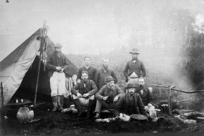
Stephenson
Percy Smith (wearing a hat & holding a pipe in his right hand) sits centrally
amongst his team in this 1886 photo. During the surveying leading up to, during
and after the sale of the Waipoua and Maunganui blocks
to the Crown, he was in charge of all government surveyors in the area and acted
as overseer to their regional activities. He was fully and meticulously conversant
with every aspect of the dispute between Parore Te Awha and Tiopira Kinaki or
others, which had held up government surveying work for seventeen months between
late 1874 and early 1876. When S. Percy Smith, in his capacity as Surveyor
General of New Zealand, responded to Te Rore Taoho's letter in 1899, he
was in possession of all pertinent documentation (which was on file at the Surveyor
General's Office) and a memory of all that had transpired, inasmuch as he was
personally involved in resolving the difficult
and bitter dispute to the satisfaction of all contending parties assembled at
the Native Land Court in 1876.
*Note: It is interesting that
Judge Acheson was later released from his position as a judge, as his all-too-accomodating
attitude interfered in his ability to make sound judgements based solely on factual
evidence. The Crown, by consequence, dealt only in documented, clinical facts
and required judges to rule or make judgements according to the law, not according
to emotion or personal sympathies.
The arrogance of modern-day authorities,
in assuming that a drove of professional individuals from 1876 onwards with "first
hand" experience in dealing with the case somehow "forgot"
to give two substantial parcels of land to "rightful owners",
is truly absurd, amazing to behold and to contemplate. The case had been regurgitated
and reviewed several times over, always with the same, carefully
researched and informed outcome, until the 1980's and 90's, when
the New Zealand Government assumed a "third party" position.
Thereafter, for the first time ever, the contest was not between the Government
and a "try it on", "nothing ventured - nothing gained"
claimant, but between the "all Maori" Waitangi Tribunal and
an isolated farming couple, deprived of the ability to defend themselves.
Their "Freehold Title" had
come via the Government, which had made the initial purchase in 1876, then on-sold
subdivided allotments to individuals in the century that followed. Now, under
the "new way of doing things" instituted in the 1980's, the Government
withdrew fully from its protective responsibility,
let original documentation pertinent to the case get stolen or conveniently lost,
allowed the sacrosanct, guaranteed nature of "Freehold
Title" be nullified and extinguished, resulting in the loss
of the Titford farm & assets in a uninhibited, unopposed Waitangi Tribunal
"free for all" and "lolly scramble".
SO,
WHAT COULD BE CLEARER OR BETTER DOCUMENTED THAN THIS?
The reason why
no further action was taken with Wi Pou's reserve proposals is that neither Wi
Pou, Tiopira Kinaki, Uriohau hapu or Ngatiwhatua iwi owned one
square inch of territory in the Maunganui Block. It is a well registered
fact that Wi Pou and his Ngaitu hapu did a "trade-off"
with Parore Te Awha, wherein he would give up all claims to Maunganui,
provided that Parore gave up claims to Tutamoe.
The entire Maunganui parcel was awarded to Parore Te Awha by the Land Court,
after unanimous agreements were reached with all contending parties, including
Tiopira Kinaki and his Te Roroa hapu. No further mention of anything "unresolved"
or "forgotten" ever cropped up in the "wills"
of the original contestants.
Parore had no desire to establish reserves
at the positions of Manuwhetai and Whangai-ariki, which could be considered "young
man's county" for hardy fishermen. The location was better adapted to
those wanting a fishing camp on the edge of the often howling and hostile West
Coast. Aged chief Parore Te Awha opted, instead, for a more placid and sheltered,
inland eel-fishery reserve of 250-acres at the picturesque fresh water lakes nearby.
The final plan drawn after his sale of the Maunganui Block to the Crown, clearly
designates the boundaries of his preferred, very tranquil Taharoa reserve.
The
Kaiiwi lake and surrounding land where Parore Te Awha set aside a reserve for
himself, called Taharoa. The location was considerably closer to his Kaihu estate
than the high ground of Maunganui Bluff. The placid waters of the lake, rather
than crashing surf of the blustery sea coast, were more suitable to the needs
of the dignified old chief, well advanced in age. Here he could live out his remaining
years in peace.
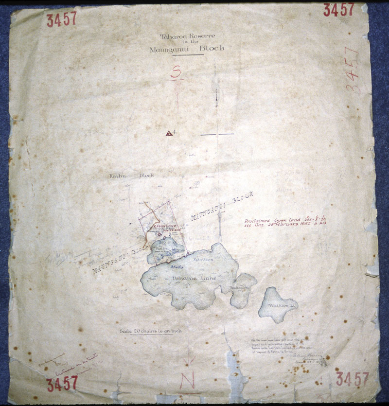
This
is the fully and accurately surveyed plan that was produced for Parore Te Awha
by the only surveyor he ever engaged to do his work, W.A. Graham. The plan was
completed on the 22nd of March 1876, a little over 6-weeks after he sold the entire
Maunganui Block to the Crown, but "bought back"
this reserve in the sale agreement. In latter years, as areas within the boundaries
of this plan were sold to the Crown, further notations were added, declaring:
Proclaimed Crown Land. This notation
was added after the Crown bought the land, assumedly off Parore Te Awha's descendants,
in 1952.
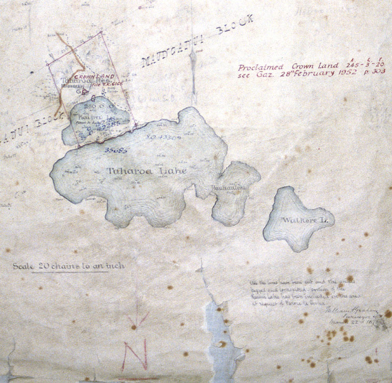
The
only reserve that Parore Te Awha wished to "buy
back" for himself after selling the entirety of his Maunganui
Block to the Crown. His chosen reserve, bearing his name as the "titled"
owner, encompassed most of Kaiiwi Lake and also bordered along the frontage of
the large Taharoa Lake. The plan notation reads: All the
lines have been cut and the angles pegged and locks-fitted - position of the Kaiiwi
Lake has been included in the area at request of Parore Te Awha.... William A.
Graham, Surveyor, March 22nd 1876.
The
fact of the matter is that neither Te Rore Taoho in 1897, nor any other Te Roroa
"opportunists" since, have ever had even the most remote vestige of
a claim on any part of Parore Te Awha's land on Maunganui Block after the Native
Land Court ruling of February 1876. The "Manuwhetai" or Whangai-ariki
reserves idea never got past the most rudimentary proposal stage and later became
an utter "non-event" when Parore Te Awha
refused to acknowledge their existence and "buy
them back" from the Crown.
This
is a part of Parore Te Awha's Taharoa Lake frontage and the foreground constitutes
one boundary of the only area that Parore Te Awha wished to "buy
back" from the Crown.
Te
Roroa "opportunist" claimants need to become conversant with the basic
process of how the Maunganui Block was disposed of: (1)
Title was awarded to the Maori owner (Parore Te Awha) by unanimous agreement in
the Native Land Court. (2) The Maori owner (Parore
Te Awha) sold the entirety of his block to the Crown, after nominating
an area that he wished to keep for a reserve. (3)
The nominated reserve area was then surveyed very accurately by William A Graham
and "officially" registered as a titled allotment, to be repurchased
by Parore Te Awha. (4) Parore Te Awha paid the
Crown for the nominated land of his pre-chosen reserve, whereupon full title
of ownership for that allotment passed to him and later to his heirs. Parore
Te Awha repurchased only what he wanted... nothing
more and nothing less!
There is nothing in this
transaction that has anything to do with anyone other than Parore Te Awha and
the Crown...end of story!
NGAPUHI
ELDER, GRAHAM RANKIN'S DYING WISH.
The Paramount chief
of Ngapuhi wished it to be known that his call for justice in the Titford case
extended beyond the grave. In order to let the world see how incensed he was
at the injustices meted out against Allan and Susan Titford, the dying chief requested
that Allan be a pallbearer at his funeral.
Graham Rankin was
a historian of great renown, whose grasp on Northern New Zealand history was unsurpassed.
He deeply researched the Titford case and knew that the claim against them was
outright fraud. He wrote the following to the Minister of Treaty Claims, calling
for redress and justice.
Graham Rankin,
16 Rankin St,
Kaikohe.
June 4th 2001.
Minister of Treaty Claims,
The Hon
Margaret Wilson.
Tena koe,
Eighteen months ago I met
a man of good Bohemian stock. I have met him several times later, a young man
with a terrible bile in his belly, and rightfully so.
No living person
should suffer the pain of he and his wife and children, at the hands of Government
and Associates, Ministers in particular. From the time the Te Roroa claim took
effect, I asked, "could this be the land of our fathers".
In
my view, how could Te Awha Parore and Tiopira own so much land, when Maori, at
some time in our history had communistic laws? The Chief only apportions a small
parcel of land for family requirements, no more, no less. The land belonged to
the Tribe not the chief.
Te Roroa people are only squatters, living
on the edge of Waipoua Forest. They don't even know what they are!! Ngatiwhatua
or Ngapuhi. Like the Israelites, driven out of the Bay of Islands to Whangaroa,
then fled with Hongi Hika in chase to Waipoua.
My Ngaitu people were
the earlier settlers, our Tupuna, Chief Kohuru of the funerary chests at Kohekohe.
I am angry that the chests were never returned to Kohekohe, but interred in a
simple ceremony at Waimamaku without permission.
I have read the
Te Roroa report, also attended the findings at Waikara Marae, men and women in
their finery, Ministers, Members of the Tribunal, others in country apparel, gumboots,
oilskins, horses, tractors and dogs, out for a great day. The big tops, a large
dining area, all at the expense of the Government of the day.
Before
the seal had set, this 15th day of May 1990, the great philosophers found there
was a grave mistake. Accordingly, a prompt change to the Act was pushed through
by Parliament, "land that was owned by private ownership should not be challenged".
The work of the claim was shoddy, unclean and destructive in the eyes of our New
Zealand Society.
My question Minister, the land can never be given
to Maori, sitting as a "crown jewel" when it should be returned to Allan
Titford, now.
I asked Titford to bring me copies, various deeds,
Court minutes, successions before writing. I am satisfied what I have witnessed,
by the sequence of events, from the time the Crown purchased Maunganui lands from
Te Awha Parore in successions, or lease, is compatible with the standard within
the law of our country.
Also let it be known to the Tribunal and
yourself, in permanent storage, Turnbull Library had "an epitome" of
official documents, relative to native offers and land purchases in the North
Island of New Zealand. A very useful follow up guide for claims. Compiled and
edited by N. Hansen Turton. There is a large section contained about Maunganui
lands.
Enclosed, is exhaustive research provided by Titford. Maps
and Deeds can be supplied if required. I am a devoted protector of my Maori Peoples
interests if a case is fair and accurate, same goes for Pakeha people.
I
must reiterate, this must be the saddest case I have come upon. Bad research coupled
by greed and inefficiency. Please have the Tribunal sight this letter. Be guided
by extra care in the future.
Tena Koe Hoi ano
Signed,
Graham Rankin, Ngapuhi elder.
Regards to our great Prime Minister.
The
history content of this article is a synopsis of the exhaustive research undertaken
by Susan Titford, great-great-great granddaughter of chief Eruera Patuone of Ngapuhi.
Main
body text writing by Martin Doutré in consultation with: Allan
Titford (dispossessed farmer), Ross Baker (Head of the One New Zealand Foundation),
Noel Hilliam (former Curator of the Dargaville Maritime Museum), Northland Historian
Joan Leaf, Ngai-Tahu historian, Jean Jackson and many other contributors.